Ormas, Indiana | |
|---|---|
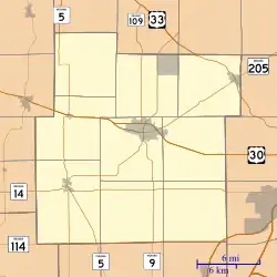 Ormas Ormas, as seen in a map of Whitley County | |
| Coordinates: 41°17′43″N 85°32′45″W / 41.29528°N 85.54583°W | |
| Country | United States |
| State | Indiana |
| County | Whitley, Noble |
| Township | Etna-Troy, Washington |
| Elevation | 906 ft (276 m) |
| Time zone | UTC-5 (Eastern (EST)) |
| • Summer (DST) | UTC-4 (EDT) |
| ZIP code | 46725 |
| Area code | 260 |
| GNIS feature ID | 450573 |
Ormas is an unincorporated community in Whitley and Noble counties, in the U.S. state of Indiana.[2]
History
Ormas was founded in 1856.[3] The community's name honors Ormas Jones, an early settler.[4]
A post office was established at Ormas in 1880, and remained in operation until it was discontinued in 1904.[5]
Geography
Ormas is located at 41°17′43″N 85°32′45″W / 41.29528°N 85.54583°W.
References
- ↑ "US Board on Geographic Names". United States Geological Survey. October 25, 2007. Retrieved July 6, 2016.
- ↑ "Ormas, Indiana". Geographic Names Information System. United States Geological Survey. Retrieved July 16, 2017.
- ↑ Baker, Ronald L. (October 1995). From Needmore to Prosperity: Hoosier Place Names in Folklore and History. Indiana University Press. p. 253. ISBN 978-0-253-32866-3.
This village was laid out on May 9, 1856...
- ↑ "Profile for Ormas, IN". ePodunk. Retrieved September 13, 2015.
- ↑ "Whitley County". Jim Forte Postal History. Retrieved September 13, 2015.
Municipalities and communities of Noble County, Indiana, United States | ||
|---|---|---|
| Cities | Map of Indiana highlighting Noble County | |
| Towns | ||
| Townships | ||
| CDPs | ||
| Other communities | ||
| Footnotes | ‡This populated place also has portions in an adjacent county or counties | |
Municipalities and communities of Whitley County, Indiana, United States | ||
|---|---|---|
| City | Map of Indiana highlighting Whitley County | |
| Towns | ||
| Townships | ||
| CDPs | ||
| Other communities | ||
| Footnotes | ‡This populated place also has portions in an adjacent county or counties | |
This article is issued from Wikipedia. The text is licensed under Creative Commons - Attribution - Sharealike. Additional terms may apply for the media files.