Ouangolodougou
Wangolodougou | |
|---|---|
Town, sub-prefecture, and commune | |
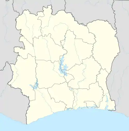 Ouangolodougou Location in Côte d'Ivoire | |
| Coordinates: 9°58′N 5°9′W / 9.967°N 5.150°W | |
| Country | |
| Region | Savanes |
| Region | Tchologo |
| Department | Ouangolodougou |
| Area | |
| • Total | 766 km2 (296 sq mi) |
| Elevation | 303 m (994 ft) |
| Population (2021 census)[1] | |
| • Total | 82,801 |
| • Density | 110/km2 (280/sq mi) |
| • Town | 37,991[2] |
| (2014 census) | |
| Time zone | UTC+0 (GMT) |
Ouangolodougou (also known as Wangolodougou) is a town in the far north of Ivory Coast, adjacent to the border with Burkina Faso. It is a sub-prefecture of and the seat of Ouangolodougou Department in Tchologo Region, Savanes District. Ouangolodougou is also a commune. In 2021, the population of the sub-prefecture of Ouangolodougou was 82,801.[1]
Ouangolodougou is situated in the sub-Saharan Sahel savanna biogeography region, which is characterised by grasslands with trees.
Transport
The town is served by a station on the Abidjan-Niger Railway.
Villages
The 14 villages of the sub-prefecture of Ouangolodougou and their population in 2014 are:[3]
- Bénifesso (763)
- Brahimadougou (4 386)
- Broundougou (2 335)
- Niornigué 1 (2 465)
- Nioronigue 2 (1 947)
- Ouangolodougou (37 991)
- Sokourani (1 086)
- Torla (2 328)
- Torla-Noumozo (188)
- Bakarydougou (2 361)
- Diarratiédougou (1 046)
- Nambingué (12 865)
- Pléouo (2 422)
- Zandanakaha (Gbinzo Ii) (2 336)
References
- 1 2 Citypopulation.de Population of the regions and sub-prefectures of Ivory Coast
- ↑ Citypopulation.de Population of cities & localities of Ivory Coast
- ↑ Citypopulation.de Population of localities in the Ouangolodougou sub-prefecture
Regional seat: Ferkessédougou | ||
| Ferkessédougou Department | 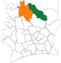 | |
| Kong Department | ||
| Ouangolodougou Department | ||
* also a commune | ||
This article is issued from Wikipedia. The text is licensed under Creative Commons - Attribution - Sharealike. Additional terms may apply for the media files.