Ouangolodougou Department
Département d'Ouangolodougou | |
|---|---|
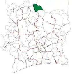 Location in Ivory Coast. Ouangolodougou Department has retained the same boundaries since its creation in 2008. | |
| Country | |
| District | Savanes |
| Region | Tchologo |
| 2008 | Established as a second-level subdivision via a division of Ferkessédougou Dept |
| 2011 | Converted to a third-level subdivision |
| Departmental seat | Ouangolodougou |
| Government | |
| • Prefect | Sihindou Coulibaly |
| Area | |
| • Total | 4,380 km2 (1,690 sq mi) |
| Population (2021 census)[2] | |
| • Total | 294,639 |
| • Density | 67/km2 (170/sq mi) |
| Time zone | UTC+0 (GMT) |
Ouangolodougou Department is a department of Tchologo Region in Savanes District, Ivory Coast. In 2021, its population was 294,639 and its seat is the settlement of Ouangolodougou. The sub-prefectures of the department are Diawala, Kaouara, Niellé, Ouangolodougou, and Toumoukoro.
History
Ouangolodougou Department was created in 2008 as a second-level subdivision via a split-off from Ferkessédougou Department.[3] At its creation, it was part of Savanes Region.
In 2011, districts were introduced as new first-level subdivisions of Ivory Coast. At the same time, regions were reorganised and became second-level subdivisions and all departments were converted into third-level subdivisions. At this time, Ouangolodougou Department became part of Tchologo Region in Savanes District.
Notes
- ↑ "Préfets de Région et de Préfets de Département (Conseil des ministres du mercredi 26 septembre 2012)", abidjan.net, 2 October 2012.
- ↑ Citypopulation.de Population of the regions and departments of Ivory Coast
- ↑ Décret n° 2008-96 du 5 mars 2008 portant création des départements de Bettié, Botro, Guéyo, Koro, Kouto, Ouangolodougou, Sinématiali, Tiapoum, Yakassé-Attobrou et Zoukougbeu.
.svg.png.webp)
Regional seat: Ferkessédougou | ||
| Ferkessédougou Department | 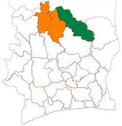 | |
| Kong Department | ||
| Ouangolodougou Department | ||
* also a commune | ||
9°58′N 5°9′W / 9.967°N 5.150°W