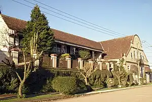
Piraquara | |
|---|---|
Municipality | |
 | |
 Flag  Seal | |
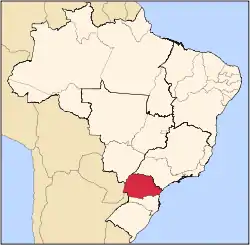
 Location of Piraquara | |
 Piraquara Location in Brazil | |
| Coordinates: 25°26′31″S 49°03′46″W / 25.44194°S 49.06278°W | |
| Country | |
| Region | Southern |
| State | Paraná |
| Mesoregion | Metropolitana de Curitiba |
| Area | |
| • Total | 87.661 sq mi (227.042 km2) |
| Population (2020 [1]) | |
| • Total | 116,822 |
| • Density | 1,300/sq mi (510/km2) |
| Time zone | UTC−3 (BRT) |
Piraquara is a municipality in the state of Paraná in the Southern Region of Brazil.[2][3][4][5]
The municipality contains part of the 3,053 hectares (7,540 acres) Serra da Baitaca State Park, created in 2002.[6]
See also
References
- ↑ IBGE 2020
- ↑ "Divisão Territorial do Brasil" (in Portuguese). Divisão Territorial do Brasil e Limites Territoriais, Instituto Brasileiro de Geografia e Estatística (IBGE). July 1, 2008. Retrieved December 17, 2009.
- ↑ "Estimativas da população para 1º de julho de 2009" (PDF) (in Portuguese). Estimativas de População, Instituto Brasileiro de Geografia e Estatística (IBGE). August 14, 2009. Retrieved December 17, 2009.
- ↑ "Ranking decrescente do IDH-M dos municípios do Brasil" (in Portuguese). Atlas do Desenvolvimento Humano, Programa das Nações Unidas para o Desenvolvimento (PNUD). 2000. Archived from the original on October 3, 2009. Retrieved December 17, 2009.
- ↑ "Produto Interno Bruto dos Municípios 2002-2005" (PDF) (in Portuguese). Instituto Brasileiro de Geografia e Estatística (IBGE). December 19, 2007. Archived from the original (PDF) on October 2, 2008. Retrieved December 17, 2009.
- ↑ PES Serra da Baitaca (in Portuguese), ISA: Instituto Socioambiental, retrieved 2016-09-20
This article is issued from Wikipedia. The text is licensed under Creative Commons - Attribution - Sharealike. Additional terms may apply for the media files.