Pourcharesses | |
|---|---|
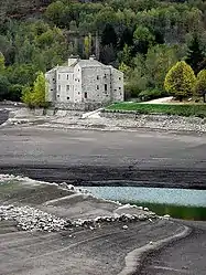 The Château de Castanet, in Pourcharesses | |
Location of Pourcharesses | |
 Pourcharesses  Pourcharesses | |
| Coordinates: 44°28′21″N 3°55′07″E / 44.47250°N 3.9186°E | |
| Country | France |
| Region | Occitania |
| Department | Lozère |
| Arrondissement | Mende |
| Canton | Saint-Étienne-du-Valdonnez |
| Intercommunality | CC Mont Lozère |
| Government | |
| • Mayor (2022–2026) | Audrey Malaval[1] |
| Area 1 | 31.79 km2 (12.27 sq mi) |
| Population | 126 |
| • Density | 4.0/km2 (10/sq mi) |
| Time zone | UTC+01:00 (CET) |
| • Summer (DST) | UTC+02:00 (CEST) |
| INSEE/Postal code | 48117 /48800 |
| Elevation | 600–1,662 m (1,969–5,453 ft) (avg. 600 m or 2,000 ft) |
| 1 French Land Register data, which excludes lakes, ponds, glaciers > 1 km2 (0.386 sq mi or 247 acres) and river estuaries. | |
Pourcharesses (French pronunciation: [puʁʃaʁɛs]; Occitan: Porchareças) is a commune in the Lozère department in southern France.[3]
See also
References
- ↑ "Répertoire national des élus: les maires" (in French). data.gouv.fr, Plateforme ouverte des données publiques françaises. 6 June 2023.
- ↑ "Populations légales 2021". The National Institute of Statistics and Economic Studies. 28 December 2023.
- ↑ INSEE commune file
Wikimedia Commons has media related to Pourcharesses.
This article is issued from Wikipedia. The text is licensed under Creative Commons - Attribution - Sharealike. Additional terms may apply for the media files.