Prague 12
Praha 12 | |
|---|---|
Municipal District of Prague Administrative District of Prague | |
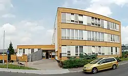 Municipal building of the district | |
 Flag  Coat of arms | |
 Location of Prague 12 in Prague | |
| Coordinates: 50°0′36″N 14°24′25″E / 50.01000°N 14.40694°E | |
| Country | Czech Republic |
| Region | Prague |
| Government | |
| • Mayor | Vojtěch Kos |
| Area | |
| • Total | 23.31 km2 (9.00 sq mi) |
| Population (2021) | |
| • Total | 56,591 |
| • Density | 2,400/km2 (6,300/sq mi) |
| Time zone | UTC+1 (CET) |
| • Summer (DST) | UTC+2 (CEST) |
| Postal code | 143 00 |
| Website | http://www.praha12.cz |
Prague 12 is a municipal district (městská část) in Prague, Czech Republic. It consists of the following cadastral subdivisions: Cholupice, Kamýk, Komořany, Modřany and Točná.
The administrative district (správní obvod) of the same name consists of municipal districts Prague 12 and Libuš.
Demographics
| Year | Pop. | ±% |
|---|---|---|
| 1869 | 1,446 | — |
| 1880 | 1,854 | +28.2% |
| 1890 | 2,452 | +32.3% |
| 1900 | 3,147 | +28.3% |
| 1910 | 3,569 | +13.4% |
| 1921 | 3,451 | −3.3% |
| 1930 | 7,113 | +106.1% |
| 1950 | 10,660 | +49.9% |
| 1961 | 11,973 | +12.3% |
| 1970 | 12,470 | +4.2% |
| 1980 | 22,051 | +76.8% |
| 1991 | 59,840 | +171.4% |
| 2001 | 54,856 | −8.3% |
| 2011 | 53,515 | −2.4% |
| 2021 | 56,591 | +5.7% |
| Source: Censuses[1][2] | ||
See also
References
- ↑ "Historický lexikon obcí České republiky 1869–2011 – Praha" (in Czech). Czech Statistical Office. 2015-12-21. pp. 7–8.
- ↑ "Population Census 2021: Population by sex". Public Database. Czech Statistical Office. 2021-03-27.
External links
This article is issued from Wikipedia. The text is licensed under Creative Commons - Attribution - Sharealike. Additional terms may apply for the media files.