Slivenec | |
|---|---|
Municipal District of Prague | |
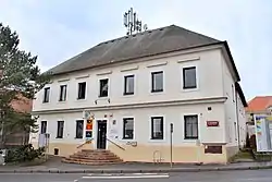 Municipal office | |
 Flag  Coat of arms | |
| Coordinates: 50°1′3″N 14°21′25″E / 50.01750°N 14.35694°E | |
| Country | Czech Republic |
| Region | Prague |
| District | Prague 11 |
| Area | |
| • Total | 5.66 km2 (2.19 sq mi) |
| Population (2021) | |
| • Total | 3,999 |
| • Density | 710/km2 (1,800/sq mi) |
| Time zone | UTC+1 (CET) |
| • Summer (DST) | UTC+2 (CEST) |
| Website | https://www.praha-slivenec.cz/ |
Slivenec is a municipal district (městská část) in Prague, Czech Republic.
Demographics
| Year | Pop. | ±% |
|---|---|---|
| 1869 | 771 | — |
| 1880 | 889 | +15.3% |
| 1890 | 1,098 | +23.5% |
| 1900 | 1,280 | +16.6% |
| 1910 | 1,283 | +0.2% |
| 1921 | 1,222 | −4.8% |
| 1930 | 1,729 | +41.5% |
| 1950 | 2,301 | +33.1% |
| 1961 | 2,294 | −0.3% |
| 1970 | 2,248 | −2.0% |
| 1980 | 2,216 | −1.4% |
| 1991 | 1,870 | −15.6% |
| 2001 | 1,994 | +6.6% |
| 2011 | 3,106 | +55.8% |
| 2021 | 3,999 | +28.8% |
| Source: Censuses[1][2] | ||
References
- ↑ "Historický lexikon obcí České republiky 1869–2011 – Praha" (in Czech). Czech Statistical Office. 2015-12-21. pp. 7–8.
- ↑ "Population Census 2021: Population by sex". Public Database. Czech Statistical Office. 2021-03-27.
This article is issued from Wikipedia. The text is licensed under Creative Commons - Attribution - Sharealike. Additional terms may apply for the media files.