Putney, Kentucky | |
|---|---|
 Putney  Putney | |
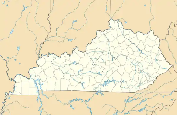
| Coordinates: 36°54′19″N 83°13′35″W / 36.90528°N 83.22639°W | |
| Country | United States |
| State | Kentucky |
| County | Harlan |
| Elevation | 1,257 ft (383 m) |
| Time zone | UTC-6 (Central (CST)) |
| • Summer (DST) | UTC-5 (CST) |
| ZIP code | 40865[1] |
| Area code | 606 |
| GNIS feature ID | 514804[2] |
Putney is an unincorporated community and coal town in Harlan County, Kentucky, United States.
References
- ↑ "Putney ZIP Code". zipdatamaps.com. 2022. Retrieved November 11, 2022.
- ↑ U.S. Geological Survey Geographic Names Information System: Putney, Kentucky
Municipalities and communities of Harlan County, Kentucky, United States | ||
|---|---|---|
| Cities | 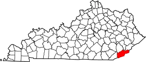 Location of Harlan County, Kentucky | |
| CDPs | ||
| Other unincorporated communities |
| |
| Ghost towns | ||
This article is issued from Wikipedia. The text is licensed under Creative Commons - Attribution - Sharealike. Additional terms may apply for the media files.