Py
Pi de Conflent | |
|---|---|
 A view within Py | |
.svg.png.webp) Coat of arms | |
Location of Py | |
 Py  Py | |
| Coordinates: 42°29′48″N 2°21′05″E / 42.4967°N 2.3514°E | |
| Country | France |
| Region | Occitania |
| Department | Pyrénées-Orientales |
| Arrondissement | Prades |
| Canton | Le Canigou |
| Government | |
| • Mayor (2020–2026) | Françoise Elliott[1] |
| Area 1 | 50.86 km2 (19.64 sq mi) |
| Population | 79 |
| • Density | 1.6/km2 (4.0/sq mi) |
| Time zone | UTC+01:00 (CET) |
| • Summer (DST) | UTC+02:00 (CEST) |
| INSEE/Postal code | 66155 /66360 |
| Elevation | 880–2,442 m (2,887–8,012 ft) (avg. 1,024 m or 3,360 ft) |
| 1 French Land Register data, which excludes lakes, ponds, glaciers > 1 km2 (0.386 sq mi or 247 acres) and river estuaries. | |
Py (French pronunciation: [pi] ⓘ; Catalan: Pi de Conflent) is a commune in the Pyrénées-Orientales department in southern France.
Geography
Py is in the canton of Le Canigou and in the arrondissement of Prades.
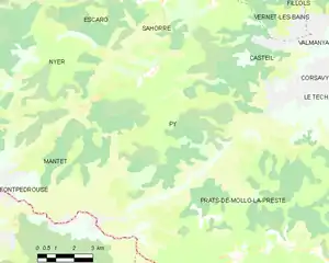
Map of Py and its surrounding communes
Population
| Year | Pop. | ±% p.a. |
|---|---|---|
| 1968 | 113 | — |
| 1975 | 102 | −1.45% |
| 1982 | 95 | −1.01% |
| 1990 | 97 | +0.26% |
| 1999 | 107 | +1.10% |
| 2007 | 110 | +0.35% |
| 2012 | 91 | −3.72% |
| 2017 | 88 | −0.67% |
| Source: INSEE[3] | ||
See also
References
- ↑ "Répertoire national des élus: les maires". data.gouv.fr, Plateforme ouverte des données publiques françaises (in French). 2 December 2020.
- ↑ "Populations légales 2021". The National Institute of Statistics and Economic Studies. 28 December 2023.
- ↑ Population en historique depuis 1968, INSEE
Wikimedia Commons has media related to Py (Pyrénées-Orientales).
This article is issued from Wikipedia. The text is licensed under Creative Commons - Attribution - Sharealike. Additional terms may apply for the media files.