Sanilhac-Sagriès | |
|---|---|
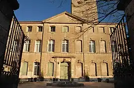 Chateau | |
.svg.png.webp) Coat of arms | |
Location of Sanilhac-Sagriès | |
 Sanilhac-Sagriès  Sanilhac-Sagriès | |
| Coordinates: 43°57′21″N 4°25′31″E / 43.9558°N 4.4253°E | |
| Country | France |
| Region | Occitania |
| Department | Gard |
| Arrondissement | Nîmes |
| Canton | Uzès |
| Government | |
| • Mayor (2020–2026) | Denis Veyrunes[1] |
| Area 1 | 22.1 km2 (8.5 sq mi) |
| Population | 813 |
| • Density | 37/km2 (95/sq mi) |
| Time zone | UTC+01:00 (CET) |
| • Summer (DST) | UTC+02:00 (CEST) |
| INSEE/Postal code | 30308 /30700 |
| Elevation | 30–202 m (98–663 ft) (avg. 105 m or 344 ft) |
| 1 French Land Register data, which excludes lakes, ponds, glaciers > 1 km2 (0.386 sq mi or 247 acres) and river estuaries. | |
Sanilhac-Sagriès (French pronunciation: [sanijak saɡʁijɛs]; Occitan: Sanilhac e Sagriers) is a commune in the Gard department in southern France.
Population
| Year | Pop. | ±% |
|---|---|---|
| 1962 | 401 | — |
| 1968 | 440 | +9.7% |
| 1975 | 442 | +0.5% |
| 1982 | 525 | +18.8% |
| 1990 | 643 | +22.5% |
| 1999 | 785 | +22.1% |
| 2008 | 834 | +6.2% |
See also
References
- ↑ "Répertoire national des élus: les maires". data.gouv.fr, Plateforme ouverte des données publiques françaises (in French). 9 August 2021.
- ↑ "Populations légales 2021". The National Institute of Statistics and Economic Studies. 28 December 2023.
Wikimedia Commons has media related to Sanilhac-Sagriès.
This article is issued from Wikipedia. The text is licensed under Creative Commons - Attribution - Sharealike. Additional terms may apply for the media files.