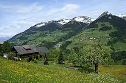
Sankt Gerold | |
|---|---|
 | |
 Coat of arms | |
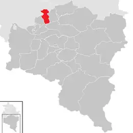 Location in the district | |
 Sankt Gerold Location within Austria | |
| Coordinates: 47°13′17″N 09°49′11″E / 47.22139°N 9.81972°E | |
| Country | Austria |
| State | Vorarlberg |
| District | Bludenz |
| Government | |
| • Mayor | Alwin Müller |
| Area | |
| • Total | 12.58 km2 (4.86 sq mi) |
| Elevation | 920 m (3,020 ft) |
| Population (2018-01-01)[2] | |
| • Total | 410 |
| • Density | 33/km2 (84/sq mi) |
| Time zone | UTC+1 (CET) |
| • Summer (DST) | UTC+2 (CEST) |
| Postal code | 6722 |
| Area code | 05550 |
| Vehicle registration | BZ |
| Website | www.st-gerold.at |
Sankt Gerold (German pronunciation: [ˌzaŋkt ˈɡeːʁɔlt]) is a municipality in the district of Bludenz in the Austrian state of Vorarlberg.
Population
| Year | Pop. | ±% |
|---|---|---|
| 1869 | 275 | — |
| 1880 | 249 | −9.5% |
| 1890 | 194 | −22.1% |
| 1900 | 209 | +7.7% |
| 1910 | 229 | +9.6% |
| 1923 | 235 | +2.6% |
| 1934 | 278 | +18.3% |
| 1939 | 244 | −12.2% |
| 1951 | 282 | +15.6% |
| 1961 | 308 | +9.2% |
| 1971 | 282 | −8.4% |
| 1981 | 321 | +13.8% |
| 1991 | 329 | +2.5% |
| 2001 | 385 | +17.0% |
| 2011 | 365 | −5.2% |
References
- ↑ "Dauersiedlungsraum der Gemeinden Politischen Bezirke und Bundesländer - Gebietsstand 1.1.2018". Statistics Austria. Retrieved 10 March 2019.
- ↑ "Einwohnerzahl 1.1.2018 nach Gemeinden mit Status, Gebietsstand 1.1.2018". Statistics Austria. Retrieved 9 March 2019.
Wikimedia Commons has media related to Sankt Gerold.
This article is issued from Wikipedia. The text is licensed under Creative Commons - Attribution - Sharealike. Additional terms may apply for the media files.