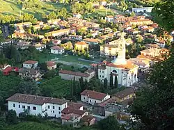
Scanzorosciate | |
|---|---|
| Comune di Scanzorosciate | |
 Rosciate | |
 Coat of arms | |
Location of Scanzorosciate | |
 Scanzorosciate Location of Scanzorosciate in Italy 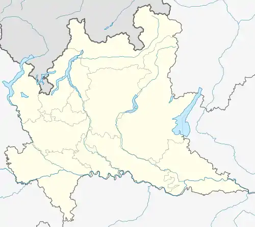 Scanzorosciate Scanzorosciate (Lombardy) | |
| Coordinates: 45°42′41″N 9°44′09″E / 45.71139°N 9.73583°E | |
| Country | Italy |
| Region | Lombardy |
| Province | Province of Bergamo (BG) |
| Frazioni | Scanzo, Rosciate, Negrone, Tribulina, Gavarno |
| Government | |
| • Mayor | Davide Casati |
| Area | |
| • Total | 10.69 km2 (4.13 sq mi) |
| Elevation | 297 m (974 ft) |
| Population (31 May 2021)[2] | |
| • Total | 9,808 |
| • Density | 920/km2 (2,400/sq mi) |
| Demonym | Scanzorosciatesi |
| Time zone | UTC+1 (CET) |
| • Summer (DST) | UTC+2 (CEST) |
| Postal code | 24020 |
| Dialing code | 035 |
| Patron saint | St. Roch |
| Saint day | August 16 |
| Website | www |
Scanzorosciate (Bergamasque: Scans) is a comune (municipality) in the Province of Bergamo in the Italian region of Lombardy, located about 50 kilometres (31 mi) northeast of Milan and about 6 kilometres (4 mi) northeast of Bergamo. As of 30 April 2013, it had a population of 10,018 and an area of 10.8 square kilometres (4.2 sq mi).[3]
Scanzorosciate borders the following municipalities: Cenate Sopra, Cenate Sotto, Gorle, Nembro, Pedrengo, Pradalunga, Ranica, San Paolo d'Argon, Torre de' Roveri, Villa di Serio.
References
- ↑ "Superficie di Comuni Province e Regioni italiane al 9 ottobre 2011". Italian National Institute of Statistics. Retrieved 16 March 2019.
- ↑ "Popolazione Residente al 1° Gennaio 2018". Italian National Institute of Statistics. Retrieved 16 March 2019.
- ↑ All demographics and other statistics: Italian statistical institute Istat.
This article is issued from Wikipedia. The text is licensed under Creative Commons - Attribution - Sharealike. Additional terms may apply for the media files.