Urcuit
Urketa | |
|---|---|
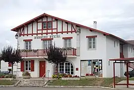 Town hall | |
.svg.png.webp) Coat of arms | |
Location of Urcuit | |
 Urcuit  Urcuit | |
| Coordinates: 43°29′11″N 1°20′07″W / 43.4864°N 1.3353°W | |
| Country | France |
| Region | Nouvelle-Aquitaine |
| Department | Pyrénées-Atlantiques |
| Arrondissement | Bayonne |
| Canton | Nive-Adour |
| Intercommunality | CA Pays Basque |
| Government | |
| • Mayor (2020–2026) | Raymond Darricarrere[1] |
| Area 1 | 13.69 km2 (5.29 sq mi) |
| Population | 2,914 |
| • Density | 210/km2 (550/sq mi) |
| Time zone | UTC+01:00 (CET) |
| • Summer (DST) | UTC+02:00 (CEST) |
| INSEE/Postal code | 64540 /64990 |
| Elevation | 0–66 m (0–217 ft) (avg. 50 m or 160 ft) |
| 1 French Land Register data, which excludes lakes, ponds, glaciers > 1 km2 (0.386 sq mi or 247 acres) and river estuaries. | |
Urcuit (French pronunciation: [yʁkɥit]; Basque: Urketa)[3] is a small village and a commune in the Pyrénées-Atlantiques department in south-western France. It is part of the traditional Basque province of Labourd.[3]
Population
| Year | Pop. | ±% p.a. |
|---|---|---|
| 1968 | 749 | — |
| 1975 | 882 | +2.36% |
| 1982 | 1,329 | +6.03% |
| 1990 | 1,688 | +3.03% |
| 1999 | 1,796 | +0.69% |
| 2007 | 2,063 | +1.75% |
| 2012 | 2,326 | +2.43% |
| 2017 | 2,492 | +1.39% |
| Source: INSEE[4] | ||
See also
References
- ↑ "Répertoire national des élus: les maires". data.gouv.fr, Plateforme ouverte des données publiques françaises (in French). 9 August 2021.
- ↑ "Populations légales 2021". The National Institute of Statistics and Economic Studies. 28 December 2023.
- 1 2 URKETA, Auñamendi Eusko Entziklopedia (in Spanish)
- ↑ Population en historique depuis 1968, INSEE
Wikimedia Commons has media related to Urcuit.
Municipalities in Labourd (Lapurdi) | ||
|---|---|---|
|  | |
This article is issued from Wikipedia. The text is licensed under Creative Commons - Attribution - Sharealike. Additional terms may apply for the media files.