Urrugne
Urruña | |
|---|---|
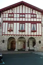 Town Hall | |
.svg.png.webp) Coat of arms | |
Location of Urrugne | |
 Urrugne  Urrugne | |
| Coordinates: 43°21′47″N 1°41′56″W / 43.3631°N 1.6989°W | |
| Country | France |
| Region | Nouvelle-Aquitaine |
| Department | Pyrénées-Atlantiques |
| Arrondissement | Bayonne |
| Canton | Hendaye-Côte Basque-Sud |
| Intercommunality | CA Pays Basque |
| Government | |
| • Mayor (2020–2026) | Philippe Aramendi[1] |
| Area 1 | 50.57 km2 (19.53 sq mi) |
| Population | 10,543 |
| • Density | 210/km2 (540/sq mi) |
| Time zone | UTC+01:00 (CET) |
| • Summer (DST) | UTC+02:00 (CEST) |
| INSEE/Postal code | 64545 /64122 |
| Elevation | 0–880 m (0–2,887 ft) (avg. 32 m or 105 ft) |
| 1 French Land Register data, which excludes lakes, ponds, glaciers > 1 km2 (0.386 sq mi or 247 acres) and river estuaries. | |
Urrugne (French pronunciation: [yʁyɲ]; Basque: Urruña)[3] is a village and a commune in the Pyrénées-Atlantiques department in south-western France. It is part of the traditional Basque province of Labourd.[3]
Population
| Year | Pop. | ±% p.a. |
|---|---|---|
| 1968 | 4,245 | — |
| 1975 | 4,571 | +1.06% |
| 1982 | 4,894 | +0.98% |
| 1990 | 6,098 | +2.79% |
| 1999 | 7,043 | +1.61% |
| 2007 | 7,759 | +1.22% |
| 2012 | 9,218 | +3.51% |
| 2017 | 10,317 | +2.28% |
| Source: INSEE[4] | ||
See also
References
- ↑ "Répertoire national des élus: les maires" (in French). data.gouv.fr, Plateforme ouverte des données publiques françaises. 13 September 2022.
- ↑ "Populations légales 2021". The National Institute of Statistics and Economic Studies. 28 December 2023.
- 1 2 URRUÑA, Auñamendi Eusko Entziklopedia (in Spanish)
- ↑ Population en historique depuis 1968, INSEE
Wikimedia Commons has media related to Urrugne.
Municipalities in Labourd (Lapurdi) | ||
|---|---|---|
|  | |
This article is issued from Wikipedia. The text is licensed under Creative Commons - Attribution - Sharealike. Additional terms may apply for the media files.