Valli del Pasubio | |
|---|---|
| Comune di Valli del Pasubio | |
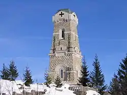 Ossary of Pasubio. | |
Location of Valli del Pasubio | |
 Valli del Pasubio Location of Valli del Pasubio in Italy 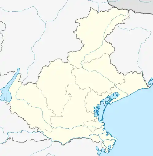 Valli del Pasubio Valli del Pasubio (Veneto) | |
| Coordinates: 45°45′N 11°16′E / 45.750°N 11.267°E | |
| Country | Italy |
| Region | Veneto |
| Province | Vicenza (VI) |
| Frazioni | Sant'Antonio, Staro |
| Government | |
| • Mayor | Armando Cunegato |
| Area | |
| • Total | 49 km2 (19 sq mi) |
| Elevation | 350 m (1,150 ft) |
| Population (31 December 2015)[2] | |
| • Total | 3,242 |
| • Density | 66/km2 (170/sq mi) |
| Demonym | Vallensi |
| Time zone | UTC+1 (CET) |
| • Summer (DST) | UTC+2 (CEST) |
| Postal code | 36030 |
| Dialing code | 0445 |
| ISTAT code | 024113 |
| Website | Official website |
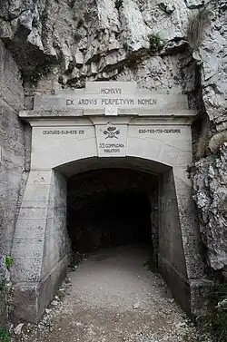
The entrance of the Strada delle 52 Gallerie
Valli del Pasubio is a town in the province of Vicenza, Veneto, Italy. It is north of SP46.
The town is a tourist destination. On the background of Valli, from right to left, are the Pasubio massif (whose highest peak is Cima Palon, also called Monte Pasubion), the Baffelan-Tre Apostoli-Cornetto (Group of Sengio Alto) group and finally, on the left, the Carega group: all are destinations for excursions and for climbing.
Main sights
References
- ↑ "Superficie di Comuni Province e Regioni italiane al 9 ottobre 2011". Italian National Institute of Statistics. Retrieved 16 March 2019.
- ↑ All demographics and other statistics from the Italian statistical institute (Istat)
This article is issued from Wikipedia. The text is licensed under Creative Commons - Attribution - Sharealike. Additional terms may apply for the media files.