| Veyle | |
|---|---|
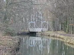 The Veyle at Pont-de-Veyle | |
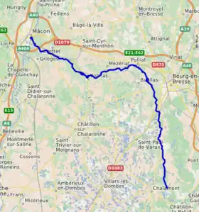 Course of the Veyle | |
| Location | |
| Country | France |
| Physical characteristics | |
| Source | Magenet pond |
| • location | Chalamont |
| • coordinates | 46°00′11″N 05°12′36″E / 46.00306°N 5.21000°E |
| • elevation | 306 m (1,004 ft) |
| Mouth | Saône |
• coordinates | 46°15′39″N 04°50′16″E / 46.26083°N 4.83778°E |
• elevation | 170 m (560 ft) |
| Length | 66.8 km (41.5 mi) |
| Discharge | |
| • average | 6.81 m3/s (240 cu ft/s) |
| Basin features | |
| Progression | Saône→ Rhône→ Mediterranean Sea |
| Tributaries | |
| • left | Irance, Renon, distributary Petit Veyle |
| • right | Menthon, Bief de Pommier, Poches stream |
The Veyle (French pronunciation: [vɛl]; Arpitan: Vêla) is a 66.8 km (41.5 mi) long river in the Ain department in eastern France.[1] Its source is in Chalamont. It flows generally northwest. It is a left tributary of the Saône, into which it flows between Grièges and Crottet, near Mâcon.
Communes along its course
This list is ordered from source to mouth:
References
Wikimedia Commons has media related to Veyle.
This article is issued from Wikipedia. The text is licensed under Creative Commons - Attribution - Sharealike. Additional terms may apply for the media files.