36°54′21″N 40°35′19″E / 36.9058°N 40.5886°E
Al-Darbasiyah Subdistrict
ناحية الدرباسية | |
|---|---|
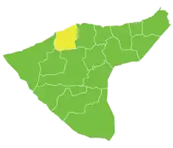 Location of Al-Darbasiyah Subdistrict within al-Hasakah Governorate | |
| Country | |
| Governorate | al-Hasakah |
| District | Ras al-Ayn District, Al-Hasakah Governorate |
| Seat | al-Darbasiyah |
| Area | |
| • Total | 994.17 km2 (383.85 sq mi) |
| Population (2004)[1] | 55,614 |
| Geocode | SY080401 |
Al-Darbasiyah Subdistrict (Arabic: ناحية الدرباسية) is a subdistrict of Ras al-Ayn District in northern al-Hasakah Governorate, northeastern Syria. The administrative centre is the city of al-Darbasiyah.
At the 2004 census, the subdistrict had a population of 55,614.[1]
Cities, towns and villages
| PCode | Name | Population |
|---|---|---|
| C5054 | al-Darbasiyah | 8,551 |
| — | Umm Dibs | 4,223 |
| — | al-Lid | 3,684 |
| C5056 | Tall Tishrin | 1,921 |
| — | al-Qirwan | 1,661 |
| — | Qaramaniyah | 1,361 |
| C5049 | Dakuk | 1,091 |
| C5064 | Tartab | 1,079 |
| — | Shatt el-Arab Sharqi | 973 |
| — | Khass Janubi | 887 |
| — | ? | 863 |
| — | Bir al-Hajar | 861 |
| — | al-Madiq | 754 |
| C5067 | Upper Tal Ghazal | 711 |
| — | Ennabiya | 707 |
| — | al-Musharifah Darbasiyah | 673 |
| — | ? | 645 |
| C5032 | Dabash | 629 |
| — | ? | 572 |
| — | Ghanamiyah Darbasiyah | 560 |
| C5055 | Jole | 530 |
| C5030 | Quneitra | 500 |
| — | ? | 497 |
| — | ? | 494 |
| — | ? | 491 |
| C5072 | Farfara Derbasiyeh | 488 |
| — | ? | 485 |
| — | ? | 481 |
| C5038 | Tal Aylul | 476 |
| C5062 | Rashidiyeh Derbasiyeh | 468 |
| C5033 | Khazneh | 456 |
| C5051 | Mashquq | 448 |
| — | ? | 424 |
| C5065 | Mahmudiyeh | 422 |
| C5041 | Jatal | 410 |
| C5046 | Shmuka Gharbia | 397 |
| — | ? | 391 |
| — | ? | 371 |
| C5073 | Malak | 363 |
| — | ? | 352 |
| — | ? | 342 |
| C5057 | Saadia Derbasiya | 341 |
| C5059 | Tal Karam Tahtani | 338 |
| C5070 | Salhiyeh Sharqiya | 329 |
| — | ? | 328 |
| — | ? | 320 |
| C5069 | Tal Khabbaz | 314 |
| — | Sawadiya | 302 |
| C5075 | Habu | 301 |
| — | ? | 295 |
| C5058 | Abu Kala | 293 |
| — | ? | 290 |
| — | ? | 287 |
| — | Ammuriyeh | 286 |
| C5040 | Tal Dik | 283 |
| C5048 | Khatuna | 278 |
| — | ? | 278 |
| — | ? | 267 |
| — | ? | 263 |
| — | ? | 260 |
| C5077 | Mishraq | 259 |
| — | ? | 258 |
| — | ? | 250 |
| C5034 | Abu Jarada | 249 |
| — | ? | 248 |
| C5060 | Torat | 245 |
| — | ? | 242 |
| — | Jinan | 236 |
| C5043 | Rihaniyet Shamr | 226 |
| C5039 | Tal Baqar | 220 |
| C5028 | Second Jozat | 204 |
| — | ? | 198 |
| C5042 | Ethamiyeh Sharqia | 197 |
| — | Qasr | 191 |
| C5036 | Salam | 190 |
| C5035 | Harshawiyeh | 189 |
| — | ? | 179 |
| C5076 | Fath Allah | 176 |
| C5045 | Tal Abbud | 176 |
| C5047 | Dalawi | 172 |
| — | ? | 172 |
| C5061 | Kukh | 164 |
| C5031 | Treifawi | 164 |
| — | ? | 163 |
| C5053 | Um Elshawali | 158 |
| C5052 | Um Ayash Fawqani | 158 |
| C5037 | Hamadaniyeh | 157 |
| C5071 | Fatima al-Maghribia | 155 |
| C5063 | Bsheiriyeh | 153 |
| — | Hamidiyeh | 152 |
| — | ? | 152 |
| — | ? | 151 |
| — | ? | 147 |
| C5068 | Heno | 146 |
| — | ? | 145 |
| C5044 | Ethamiyeh Gharbia | 138 |
| — | ? | 137 |
| — | ? | 124 |
| — | ? | 119 |
| — | ? | 108 |
| — | ? | 107 |
| — | ? | 105 |
| — | ? | 99 |
| — | ? | 95 |
| — | ? | 91 |
| — | Baath | 81 |
| — | ? | 81 |
| — | ? | 80 |
| — | ? | 71 |
| C5074 | Eastern Fatima | 64 |
| C5029 | Turbeh | 52 |
| C5066 | Jdideh | 50 |
| C5050 | Tal Sukkar | 25 |
References
- 1 2 "2004 Census Data for Nahiya al-Darbasiyah" (in Arabic). Syrian Central Bureau of Statistics. Archived from the original on 2016-03-04. Retrieved 15 October 2015. Also available in English: "2004 Census Data". UN OCHA. Retrieved 15 October 2015.
This article is issued from Wikipedia. The text is licensed under Creative Commons - Attribution - Sharealike. Additional terms may apply for the media files.