Markada Subdistrict
ناحية مركدة | |
|---|---|
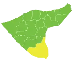 Location of Markada Subdistrict within al-Hasakah Governorate | |
| Country | |
| Governorate | al-Hasakah |
| District | Al-Hasakah District, Al-Hasakah Governorate |
| Seat | Markada |
| Area | |
| • Total | 3,383.44 km2 (1,306.35 sq mi) |
| Population (2004)[1] | 34,745 |
| Geocode | SY080003 |
Markada Subdistrict (Arabic: ناحية مركدة) is a subdistrict of al-Hasakah District in southern al-Hasakah Governorate, northeastern Syria. The Administrative centre is the city of Markada.
At the 2004 census, the subdistrict had a population of 58,916.[1]
Cities, towns and villages
| PCode | Name | Population |
|---|---|---|
| C4450 | Tell Safouk | 5,781 |
| C4449 | al-Fadghami | 5,062 |
| — | ? | 4,188 |
| — | Eastern Markada | 3,766 |
| — | Western Dashaa | 3,058 |
| — | Sheikh Hamad | 3,056 |
| — | ? | 2,880 |
| C4454 | Markada | 2,530 |
| C4453 | Kishkish Zyanat | 1,696 |
| C4448 | Elwet Eldisheisha | 1,212 |
| C4451 | Shamasani | 738 |
| — | ? | 492 |
| C4452 | Thalja | 286 |
References
- 1 2 "2004 Census Data for Nahiyah Markada" (in Arabic). Syrian Central Bureau of Statistics. Archived from the original on 23 June 2014. Retrieved 15 October 2015. Also available in English: "2004 Census Data". UN OCHA. Retrieved 15 October 2015.
This article is issued from Wikipedia. The text is licensed under Creative Commons - Attribution - Sharealike. Additional terms may apply for the media files.