Al-Shaddadah Subdistrict
ناحية الشدادي | |
|---|---|
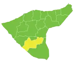 Location of Al-Shaddadah Subdistrict within al-Hasakah Governorate | |
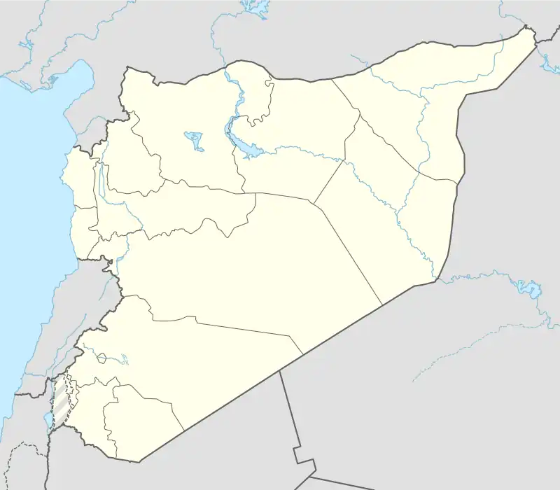 Al-Shaddadah Subdistrict Location in Syria | |
| Coordinates (al-Shaddadah): 36°03′08″N 40°46′18″E / 36.0522°N 40.7717°E | |
| Country | |
| Governorate | al-Hasakah |
| District | Al-Hasakah District, Al-Hasakah Governorate |
| Seat | al-Shaddadah |
| Area | |
| • Total | 1,935.05 km2 (747.13 sq mi) |
| Population (2004)[1] | 58,916 |
| Geocode | SY080002 |
Al-Shaddadah Subdistrict (Arabic: ناحية الشدادي) is a subdistrict of al-Hasakah District in southern al-Hasakah Governorate, northeastern Syria. Administrative centre is the city of al-Shaddadah.
At the 2004 census, the subdistrict had a population of 58,916.[1]
Cities, towns and villages
| PCode | Name | Population |
|---|---|---|
| C4446 | al-Shaddadah | 15,806 |
| C4441 | al-Sabaa wa Arbain | 14,177 |
| — | Ghurery | 4,081 |
| C4439 | Hweizeh | 3,515 |
| C4443 | Western Jermez | 3,351 |
| C4445 | Eastern Henna | 3,304 |
| C4444 | Tarnabet Elrafee | 2,734 |
| — | Abajdla | 1,852 |
| — | Western Rashidiya | 1,806 |
| C4442 | Adla | 1,623 |
| — | al-Alwa | 1,431 |
| C4438 | Eastern Rashidiya | 1,381 |
| — | Tell Gaar | 1,376 |
| — | al-Hummar | 1,029 |
| C4447 | Kishkish Jabbur | 947 |
| C4440 | Eastern Elweh | 503 |
References
- 1 2 "2004 Census Data for Nahiya al-Shaddadah" (in Arabic). Syrian Central Bureau of Statistics. Archived from the original on 10 October 2017. Retrieved 15 October 2015. Also available in English: "2004 Census Data". UN OCHA. Retrieved 15 October 2015.
This article is issued from Wikipedia. The text is licensed under Creative Commons - Attribution - Sharealike. Additional terms may apply for the media files.