Ateleta | |
|---|---|
| Comune di Ateleta | |
 | |
Location of Ateleta | |
 Ateleta Location of Ateleta in Italy 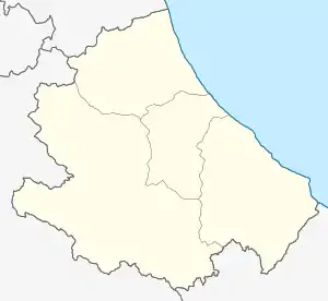 Ateleta Ateleta (Abruzzo) | |
| Coordinates: 41°51′23″N 14°11′54″E / 41.85639°N 14.19833°E | |
| Country | Italy |
| Region | Abruzzo |
| Province | L'Aquila (AQ) |
| Frazioni | Carceri Alte, Carceri Basse, Colli, Sant'Elena |
| Government | |
| • Mayor | Giacinto Donatelli |
| Area | |
| • Total | 41.62 km2 (16.07 sq mi) |
| Elevation | 760 m (2,490 ft) |
| Population (30 April 2017)[2] | |
| • Total | 1,161 |
| • Density | 28/km2 (72/sq mi) |
| Demonym | Ateletesi |
| Time zone | UTC+1 (CET) |
| • Summer (DST) | UTC+2 (CEST) |
| Postal code | 67030 |
| Dialing code | 0864 |
| Patron saint | St. Vincent Ferrer |
| Saint day | April 5 |
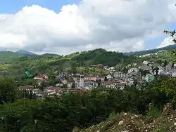
Ateleta is a comune and town in the province of L'Aquila in the Abruzzo region of central-southern Italy.
References
- ↑ "Superficie di Comuni Province e Regioni italiane al 9 ottobre 2011". Italian National Institute of Statistics. Retrieved 16 March 2019.
- ↑ "Popolazione Residente al 1° Gennaio 2018". Italian National Institute of Statistics. Retrieved 16 March 2019.
This article is issued from Wikipedia. The text is licensed under Creative Commons - Attribution - Sharealike. Additional terms may apply for the media files.