Auradou | |
|---|---|
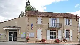 The town hall in Auradou | |
.svg.png.webp) Coat of arms | |
Location of Auradou | |
 Auradou  Auradou | |
| Coordinates: 44°20′06″N 0°48′40″E / 44.335°N 0.811°E | |
| Country | France |
| Region | Nouvelle-Aquitaine |
| Department | Lot-et-Garonne |
| Arrondissement | Villeneuve-sur-Lot |
| Canton | Le Pays de Serres |
| Intercommunality | CC Fumel Vallée Lot |
| Government | |
| • Mayor (2020–2026) | Séverine Bouchez Rezé[1] |
| Area 1 | 11.17 km2 (4.31 sq mi) |
| Population | 432 |
| • Density | 39/km2 (100/sq mi) |
| Time zone | UTC+01:00 (CET) |
| • Summer (DST) | UTC+02:00 (CEST) |
| INSEE/Postal code | 47017 /47140 |
| Elevation | 69–222 m (226–728 ft) (avg. 50 m or 160 ft) |
| 1 French Land Register data, which excludes lakes, ponds, glaciers > 1 km2 (0.386 sq mi or 247 acres) and river estuaries. | |
Auradou (French pronunciation: [oʁadu]; Occitan: Aurador) is a commune in the Lot-et-Garonne department in southwestern France.
Population
| Year | Pop. | ±% p.a. |
|---|---|---|
| 1968 | 227 | — |
| 1975 | 220 | −0.45% |
| 1982 | 256 | +2.19% |
| 1990 | 311 | +2.46% |
| 1999 | 258 | −2.05% |
| 2009 | 379 | +3.92% |
| 2014 | 382 | +0.16% |
| 2020 | 422 | +1.67% |
| Source: INSEE[3] | ||
See also
References
- ↑ "Répertoire national des élus: les maires" (in French). data.gouv.fr, Plateforme ouverte des données publiques françaises. 13 September 2022.
- ↑ "Populations légales 2021". The National Institute of Statistics and Economic Studies. 28 December 2023.
- ↑ Population en historique depuis 1968, INSEE
Wikimedia Commons has media related to Auradou.
This article is issued from Wikipedia. The text is licensed under Creative Commons - Attribution - Sharealike. Additional terms may apply for the media files.