Loubès-Bernac | |
|---|---|
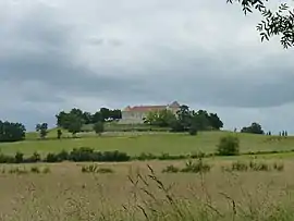 Château de Théobon | |
Location of Loubès-Bernac | |
 Loubès-Bernac  Loubès-Bernac | |
| Coordinates: 44°43′54″N 0°17′42″E / 44.7317°N 0.295°E | |
| Country | France |
| Region | Nouvelle-Aquitaine |
| Department | Lot-et-Garonne |
| Arrondissement | Marmande |
| Canton | Les Coteaux de Guyenne |
| Intercommunality | CC du Pays de Duras |
| Government | |
| • Mayor (2020–2026) | Joël Kleiber[1] |
| Area 1 | 19.31 km2 (7.46 sq mi) |
| Population | 414 |
| • Density | 21/km2 (56/sq mi) |
| Time zone | UTC+01:00 (CET) |
| • Summer (DST) | UTC+02:00 (CEST) |
| INSEE/Postal code | 47151 /47120 |
| Elevation | 74–187 m (243–614 ft) (avg. 150 m or 490 ft) |
| 1 French Land Register data, which excludes lakes, ponds, glaciers > 1 km2 (0.386 sq mi or 247 acres) and river estuaries. | |
Loubès-Bernac (French pronunciation: [lubɛs bɛʁnak]; Occitan: Lobés e Bernac) is a commune in the Lot-et-Garonne department in south-western France.[3]
See also
References
- ↑ "Répertoire national des élus: les maires" (in French). data.gouv.fr, Plateforme ouverte des données publiques françaises. 13 September 2022.
- ↑ "Populations légales 2021". The National Institute of Statistics and Economic Studies. 28 December 2023.
- ↑ Commune de Loubès-Bernac (47151), INSEE
External links
- Official website

 Media related to Loubès-Bernac at Wikimedia Commons
This article is issued from Wikipedia. The text is licensed under Creative Commons - Attribution - Sharealike. Additional terms may apply for the media files.