Bonnée | |
|---|---|
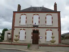 Town hall | |
Location of Bonnée | |
 Bonnée  Bonnée | |
| Coordinates: 47°47′52″N 2°22′59″E / 47.7978°N 2.3831°E | |
| Country | France |
| Region | Centre-Val de Loire |
| Department | Loiret |
| Arrondissement | Orléans |
| Canton | Sully-sur-Loire |
| Government | |
| • Mayor (2020–2026) | Michel Auger[1] |
| Area 1 | 11.61 km2 (4.48 sq mi) |
| Population | 702 |
| • Density | 60/km2 (160/sq mi) |
| Time zone | UTC+01:00 (CET) |
| • Summer (DST) | UTC+02:00 (CEST) |
| INSEE/Postal code | 45039 /45460 |
| Elevation | 111–118 m (364–387 ft) |
| 1 French Land Register data, which excludes lakes, ponds, glaciers > 1 km2 (0.386 sq mi or 247 acres) and river estuaries. | |
Bonnée (French pronunciation: [bɔne]) is a commune in the Loiret department in north-central France.
Population
| Year | Pop. | ±% p.a. |
|---|---|---|
| 1968 | 570 | — |
| 1975 | 590 | +0.49% |
| 1982 | 651 | +1.42% |
| 1990 | 638 | −0.25% |
| 1999 | 658 | +0.34% |
| 2009 | 668 | +0.15% |
| 2014 | 687 | +0.56% |
| 2020 | 706 | +0.46% |
| Source: INSEE[3] | ||
See also
References
- ↑ "Répertoire national des élus: les maires" (in French). data.gouv.fr, Plateforme ouverte des données publiques françaises. 4 May 2022.
- ↑ "Populations légales 2021". The National Institute of Statistics and Economic Studies. 28 December 2023.
- ↑ Population en historique depuis 1968, INSEE
Wikimedia Commons has media related to Bonnée.
This article is issued from Wikipedia. The text is licensed under Creative Commons - Attribution - Sharealike. Additional terms may apply for the media files.