Boynes | |
|---|---|
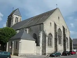 The church in Boynes | |
.svg.png.webp) Coat of arms | |
Location of Boynes | |
 Boynes  Boynes | |
| Coordinates: 48°07′15″N 2°21′39″E / 48.1208°N 2.3608°E | |
| Country | France |
| Region | Centre-Val de Loire |
| Department | Loiret |
| Arrondissement | Pithiviers |
| Canton | Le Malesherbois |
| Intercommunality | Pithiverais |
| Government | |
| • Mayor (2020–2026) | Thierry Barjonet[1] |
| Area 1 | 15.43 km2 (5.96 sq mi) |
| Population | 1,323 |
| • Density | 86/km2 (220/sq mi) |
| Time zone | UTC+01:00 (CET) |
| • Summer (DST) | UTC+02:00 (CEST) |
| INSEE/Postal code | 45050 /45300 |
| Elevation | 105–123 m (344–404 ft) |
| 1 French Land Register data, which excludes lakes, ponds, glaciers > 1 km2 (0.386 sq mi or 247 acres) and river estuaries. | |
Boynes (French pronunciation: [bwan]) is a commune in the Loiret department in north-central France.
Population
| Year | Pop. | ±% p.a. |
|---|---|---|
| 1968 | 971 | — |
| 1975 | 1,009 | +0.55% |
| 1982 | 963 | −0.66% |
| 1990 | 978 | +0.19% |
| 1999 | 1,014 | +0.40% |
| 2009 | 1,237 | +2.01% |
| 2014 | 1,324 | +1.37% |
| 2020 | 1,326 | +0.03% |
| Source: INSEE[3] | ||
See also
References
- ↑ "Répertoire national des élus: les maires" (in French). data.gouv.fr, Plateforme ouverte des données publiques françaises. 13 September 2022.
- ↑ "Populations légales 2021". The National Institute of Statistics and Economic Studies. 28 December 2023.
- ↑ Population en historique depuis 1968, INSEE
Wikimedia Commons has media related to Boynes.
This article is issued from Wikipedia. The text is licensed under Creative Commons - Attribution - Sharealike. Additional terms may apply for the media files.