Champanges | |
|---|---|
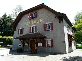 Town Hall | |
 Coat of arms | |
Location of Champanges | |
 Champanges  Champanges | |
| Coordinates: 46°22′14″N 6°33′05″E / 46.3706°N 6.5514°E | |
| Country | France |
| Region | Auvergne-Rhône-Alpes |
| Department | Haute-Savoie |
| Arrondissement | Thonon-les-Bains |
| Canton | Évian-les-Bains |
| Intercommunality | Pays d'Évian Vallée d'Abondance |
| Government | |
| • Mayor (2020–2026) | Rénato Gobber[1] |
| Area 1 | 3.71 km2 (1.43 sq mi) |
| Population | 1,154 |
| • Density | 310/km2 (810/sq mi) |
| Demonym | Champangeois |
| Time zone | UTC+01:00 (CET) |
| • Summer (DST) | UTC+02:00 (CEST) |
| INSEE/Postal code | 74057 /74500 |
| Elevation | 640–782 m (2,100–2,566 ft) |
| Website | champanges |
| 1 French Land Register data, which excludes lakes, ponds, glaciers > 1 km2 (0.386 sq mi or 247 acres) and river estuaries. | |
Champanges (French pronunciation: [ʃɑ̃pɑ̃ʒ]; Arpitan: Champenjo) is a commune in the Haute-Savoie department in the Auvergne-Rhône-Alpes region in south-eastern France.[3] An Alpine community, with a tourist and camping industry, it is close to Lake Leman and the French-Swiss border.
See also
References
- ↑ "Répertoire national des élus: les maires". data.gouv.fr, Plateforme ouverte des données publiques françaises (in French). 2 December 2020.
- ↑ "Populations légales 2021". The National Institute of Statistics and Economic Studies. 28 December 2023.
- ↑ Commune de Champanges (74057), INSEE
Wikimedia Commons has media related to Champanges.
This article is issued from Wikipedia. The text is licensed under Creative Commons - Attribution - Sharealike. Additional terms may apply for the media files.