Chezelles | |
|---|---|
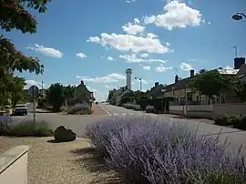 The well-kept village of Chezelles | |
Location of Chezelles | |
 Chezelles  Chezelles | |
| Coordinates: 46°53′27″N 1°34′35″E / 46.8908°N 1.5764°E | |
| Country | France |
| Region | Centre-Val de Loire |
| Department | Indre |
| Arrondissement | Châteauroux |
| Canton | Buzançais |
| Intercommunality | Val de l'Indre-Brenne |
| Government | |
| • Mayor (2020–2026) | Philippe Yvon[1] |
| Area 1 | 17.32 km2 (6.69 sq mi) |
| Population | 447 |
| • Density | 26/km2 (67/sq mi) |
| Time zone | UTC+01:00 (CET) |
| • Summer (DST) | UTC+02:00 (CEST) |
| INSEE/Postal code | 36050 /36500 |
| Elevation | 132–171 m (433–561 ft) (avg. 163 m or 535 ft) |
| 1 French Land Register data, which excludes lakes, ponds, glaciers > 1 km2 (0.386 sq mi or 247 acres) and river estuaries. | |
Chezelles (French pronunciation: [ʃəzɛl]) is a commune in the Indre department in central France.
Population
| Year | Pop. | ±% p.a. |
|---|---|---|
| 1968 | 419 | — |
| 1975 | 381 | −1.35% |
| 1982 | 379 | −0.08% |
| 1990 | 402 | +0.74% |
| 1999 | 409 | +0.19% |
| 2009 | 427 | +0.43% |
| 2014 | 469 | +1.89% |
| 2020 | 448 | −0.76% |
| Source: INSEE[3] | ||
See also
References
- ↑ "Répertoire national des élus: les maires". data.gouv.fr, Plateforme ouverte des données publiques françaises (in French). 2 December 2020.
- ↑ "Populations légales 2021". The National Institute of Statistics and Economic Studies. 28 December 2023.
- ↑ Population en historique depuis 1968, INSEE
Wikimedia Commons has media related to Chezelles (Indre).
This article is issued from Wikipedia. The text is licensed under Creative Commons - Attribution - Sharealike. Additional terms may apply for the media files.