Lye | |
|---|---|
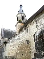 The Church of Notre-Dame, in Lye | |
.svg.png.webp) Coat of arms | |
Location of Lye | |
 Lye  Lye | |
| Coordinates: 47°13′43″N 1°28′28″E / 47.2286°N 1.4744°E | |
| Country | France |
| Region | Centre-Val de Loire |
| Department | Indre |
| Arrondissement | Châteauroux |
| Canton | Valençay |
| Government | |
| • Mayor (2020–2026) | Francis Jourdain[1] |
| Area 1 | 24.77 km2 (9.56 sq mi) |
| Population | 741 |
| • Density | 30/km2 (77/sq mi) |
| Time zone | UTC+01:00 (CET) |
| • Summer (DST) | UTC+02:00 (CEST) |
| INSEE/Postal code | 36107 /36600 |
| Elevation | 76–136 m (249–446 ft) (avg. 70 m or 230 ft) |
| 1 French Land Register data, which excludes lakes, ponds, glaciers > 1 km2 (0.386 sq mi or 247 acres) and river estuaries. | |
Lye (French pronunciation: [li]) is a commune in the Indre department in central France.
Population
| Year | Pop. | ±% p.a. |
|---|---|---|
| 1968 | 997 | — |
| 1975 | 924 | −1.08% |
| 1982 | 932 | +0.12% |
| 1990 | 850 | −1.14% |
| 1999 | 802 | −0.64% |
| 2009 | 815 | +0.16% |
| 2014 | 813 | −0.05% |
| 2020 | 740 | −1.56% |
| Source: INSEE[3] | ||
See also
References
- ↑ "Répertoire national des élus: les maires". data.gouv.fr, Plateforme ouverte des données publiques françaises (in French). 9 August 2021.
- ↑ "Populations légales 2021". The National Institute of Statistics and Economic Studies. 28 December 2023.
- ↑ Population en historique depuis 1968, INSEE
External links
Wikimedia Commons has media related to Lye.
This article is issued from Wikipedia. The text is licensed under Creative Commons - Attribution - Sharealike. Additional terms may apply for the media files.