La Vernelle | |
|---|---|
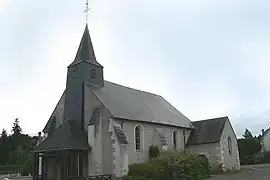 The church in La Vernelle | |
Location of La Vernelle | |
 La Vernelle  La Vernelle | |
| Coordinates: 47°14′56″N 1°32′38″E / 47.2489°N 1.5439°E | |
| Country | France |
| Region | Centre-Val de Loire |
| Department | Indre |
| Arrondissement | Châteauroux |
| Canton | Valençay |
| Intercommunality | Écueillé-Valençay |
| Government | |
| • Mayor (2020–2026) | Annick Brossier[1] |
| Area 1 | 17.08 km2 (6.59 sq mi) |
| Population | 780 |
| • Density | 46/km2 (120/sq mi) |
| Time zone | UTC+01:00 (CET) |
| • Summer (DST) | UTC+02:00 (CEST) |
| INSEE/Postal code | 36233 /36600 |
| Elevation | 71–114 m (233–374 ft) (avg. 81 m or 266 ft) |
| 1 French Land Register data, which excludes lakes, ponds, glaciers > 1 km2 (0.386 sq mi or 247 acres) and river estuaries. | |
La Vernelle (French pronunciation: [la vɛʁnɛl]) is a commune in the Indre department in central France.[3]
Population
| Year | Pop. | ±% p.a. |
|---|---|---|
| 1968 | 715 | — |
| 1975 | 713 | −0.04% |
| 1982 | 696 | −0.34% |
| 1990 | 640 | −1.04% |
| 1999 | 693 | +0.89% |
| 2009 | 781 | +1.20% |
| 2014 | 771 | −0.26% |
| 2020 | 760 | −0.24% |
| Source: INSEE[4] | ||
See also
References
- ↑ "Répertoire national des élus: les maires". data.gouv.fr, Plateforme ouverte des données publiques françaises (in French). 9 August 2021.
- ↑ "Populations légales 2021". The National Institute of Statistics and Economic Studies. 28 December 2023.
- ↑ INSEE commune file
- ↑ Population en historique depuis 1968, INSEE
Wikimedia Commons has media related to La Vernelle.
This article is issued from Wikipedia. The text is licensed under Creative Commons - Attribution - Sharealike. Additional terms may apply for the media files.