Clermont-le-Fort | |
|---|---|
 Town hall | |
.svg.png.webp) Coat of arms | |
Location of Clermont-le-Fort | |
 Clermont-le-Fort  Clermont-le-Fort | |
| Coordinates: 43°27′32″N 1°26′00″E / 43.4589°N 1.4333°E | |
| Country | France |
| Region | Occitania |
| Department | Haute-Garonne |
| Arrondissement | Toulouse |
| Canton | Castanet-Tolosan |
| Intercommunality | CA Sicoval |
| Government | |
| • Mayor (2020–2026) | Élisabeth Giachetto[1] |
| Area 1 | 10.04 km2 (3.88 sq mi) |
| Population | 521 |
| • Density | 52/km2 (130/sq mi) |
| Time zone | UTC+01:00 (CET) |
| • Summer (DST) | UTC+02:00 (CEST) |
| INSEE/Postal code | 31148 /31810 |
| Elevation | 152–282 m (499–925 ft) (avg. 240 m or 790 ft) |
| 1 French Land Register data, which excludes lakes, ponds, glaciers > 1 km2 (0.386 sq mi or 247 acres) and river estuaries. | |
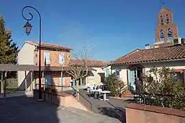
Clermont-le-Fort (French pronunciation: [klɛʁmɔ̃ lə fɔʁ]; Occitan: Clarmont) is a commune in the Haute-Garonne department in southwestern France.
Geography
The Ariège forms most of the commune's western border, with the Lèze, one of its tributaries, which flows here into the Ariège.
Population
| Year | Pop. | ±% |
|---|---|---|
| 1962 | 241 | — |
| 1968 | 242 | +0.4% |
| 1975 | 250 | +3.3% |
| 1982 | 308 | +23.2% |
| 1990 | 359 | +16.6% |
| 1999 | 464 | +29.2% |
| 2008 | 517 | +11.4% |
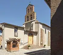 Church St Peter.
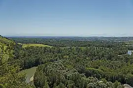 Panorama
See also
References
- ↑ "Répertoire national des élus: les maires" (in French). data.gouv.fr, Plateforme ouverte des données publiques françaises. 13 September 2022.
- ↑ "Populations légales 2021". The National Institute of Statistics and Economic Studies. 28 December 2023.
Wikimedia Commons has media related to Clermont-le-Fort.
This article is issued from Wikipedia. The text is licensed under Creative Commons - Attribution - Sharealike. Additional terms may apply for the media files.