Saint-Rome | |
|---|---|
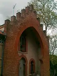 Typical house | |
Location of Saint-Rome | |
 Saint-Rome  Saint-Rome | |
| Coordinates: 43°24′56″N 1°40′40″E / 43.4156°N 1.6778°E | |
| Country | France |
| Region | Occitania |
| Department | Haute-Garonne |
| Arrondissement | Toulouse |
| Canton | Revel |
| Government | |
| • Mayor (2020–2026) | Geoffroy de La Panouse[1] |
| Area 1 | 3.63 km2 (1.40 sq mi) |
| Population | 58 |
| • Density | 16/km2 (41/sq mi) |
| Time zone | UTC+01:00 (CET) |
| • Summer (DST) | UTC+02:00 (CEST) |
| INSEE/Postal code | 31514 /31290 |
| Elevation | 163–174 m (535–571 ft) (avg. 170 m or 560 ft) |
| 1 French Land Register data, which excludes lakes, ponds, glaciers > 1 km2 (0.386 sq mi or 247 acres) and river estuaries. | |
Saint-Rome (French pronunciation: [sɛ̃ ʁɔm]; Languedocien: Sent Roma) is a commune in the Haute-Garonne department in southwestern France.
Population
| Year | Pop. | ±% |
|---|---|---|
| 1962 | 95 | — |
| 1968 | 108 | +13.7% |
| 1975 | 81 | −25.0% |
| 1982 | 93 | +14.8% |
| 1990 | 74 | −20.4% |
| 1999 | 68 | −8.1% |
| 2008 | 59 | −13.2% |
See also
References
- ↑ "Répertoire national des élus: les maires". data.gouv.fr, Plateforme ouverte des données publiques françaises (in French). 2 December 2020.
- ↑ "Populations légales 2021". The National Institute of Statistics and Economic Studies. 28 December 2023.
Wikimedia Commons has media related to Saint-Rome.
This article is issued from Wikipedia. The text is licensed under Creative Commons - Attribution - Sharealike. Additional terms may apply for the media files.