Dramelay | |
|---|---|
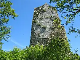 Tower of the Chateau | |
 Coat of arms | |
Location of Dramelay | |
 Dramelay  Dramelay | |
| Coordinates: 46°24′27″N 5°32′12″E / 46.4075°N 5.5367°E | |
| Country | France |
| Region | Bourgogne-Franche-Comté |
| Department | Jura |
| Arrondissement | Lons-le-Saunier |
| Canton | Moirans-en-Montagne |
| Government | |
| • Mayor (2020–2026) | Philippe Lamard[1] |
| Area 1 | 6.53 km2 (2.52 sq mi) |
| Population | 27 |
| • Density | 4.1/km2 (11/sq mi) |
| Time zone | UTC+01:00 (CET) |
| • Summer (DST) | UTC+02:00 (CEST) |
| INSEE/Postal code | 39204 /39240 |
| Elevation | 340–629 m (1,115–2,064 ft) |
| 1 French Land Register data, which excludes lakes, ponds, glaciers > 1 km2 (0.386 sq mi or 247 acres) and river estuaries. | |
Dramelay (French pronunciation: [dʁamlɛ]) is a commune in the Jura department in Bourgogne-Franche-Comté in eastern France.[3]
Population
| Year | Pop. | ±% p.a. |
|---|---|---|
| 1968 | 45 | — |
| 1975 | 43 | −0.65% |
| 1982 | 43 | +0.00% |
| 1990 | 44 | +0.29% |
| 1999 | 32 | −3.48% |
| 2009 | 33 | +0.31% |
| 2014 | 31 | −1.24% |
| 2020 | 29 | −1.11% |
| Source: INSEE[4] | ||
See also
References
- ↑ "Répertoire national des élus: les maires". data.gouv.fr, Plateforme ouverte des données publiques françaises (in French). 2 December 2020.
- ↑ "Populations légales 2021". The National Institute of Statistics and Economic Studies. 28 December 2023.
- ↑ INSEE commune file
- ↑ Population en historique depuis 1968, INSEE
Wikimedia Commons has media related to Dramelay.
This article is issued from Wikipedia. The text is licensed under Creative Commons - Attribution - Sharealike. Additional terms may apply for the media files.