Petit-Noir | |
|---|---|
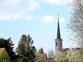 The church tower in Petit-Noir | |
Location of Petit-Noir | |
 Petit-Noir  Petit-Noir | |
| Coordinates: 46°56′17″N 5°20′34″E / 46.9381°N 5.3428°E | |
| Country | France |
| Region | Bourgogne-Franche-Comté |
| Department | Jura |
| Arrondissement | Dole |
| Canton | Tavaux |
| Government | |
| • Mayor (2020–2026) | Étienne Cordier[1] |
| Area 1 | 20.52 km2 (7.92 sq mi) |
| Population | 1,070 |
| • Density | 52/km2 (140/sq mi) |
| Time zone | UTC+01:00 (CET) |
| • Summer (DST) | UTC+02:00 (CEST) |
| INSEE/Postal code | 39415 /39120 |
| Elevation | 177–215 m (581–705 ft) |
| 1 French Land Register data, which excludes lakes, ponds, glaciers > 1 km2 (0.386 sq mi or 247 acres) and river estuaries. | |
Petit-Noir (French pronunciation: [pəti nwaʁ]) is a commune in the Jura department in Bourgogne-Franche-Comté in eastern France.[3]
Population
| Year | Pop. | ±% p.a. |
|---|---|---|
| 1968 | 717 | — |
| 1975 | 804 | +1.65% |
| 1982 | 929 | +2.09% |
| 1990 | 938 | +0.12% |
| 1999 | 974 | +0.42% |
| 2009 | 1,179 | +1.93% |
| 2014 | 1,134 | −0.78% |
| 2020 | 1,093 | −0.61% |
| Source: INSEE[4] | ||
See also
References
- ↑ "Répertoire national des élus: les maires" (in French). data.gouv.fr, Plateforme ouverte des données publiques françaises. 13 September 2022.
- ↑ "Populations légales 2021". The National Institute of Statistics and Economic Studies. 28 December 2023.
- ↑ INSEE commune file
- ↑ Population en historique depuis 1968, INSEE
Wikimedia Commons has media related to Petit-Noir.
This article is issued from Wikipedia. The text is licensed under Creative Commons - Attribution - Sharealike. Additional terms may apply for the media files.