Gerlosberg | |
|---|---|
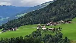 View of Gerlosberg | |
 Coat of arms | |
 Gerlosberg Location within Austria | |
| Coordinates: 47°13′00″N 11°55′00″E / 47.21667°N 11.91667°E | |
| Country | Austria |
| State | Tyrol |
| District | Schwaz |
| Government | |
| • Mayor | Josef Kerschdorfer |
| Area | |
| • Total | 16.2 km2 (6.3 sq mi) |
| Elevation | 1,050 m (3,440 ft) |
| Population (2018-01-01)[2] | |
| • Total | 465 |
| • Density | 29/km2 (74/sq mi) |
| Time zone | UTC+1 (CET) |
| • Summer (DST) | UTC+2 (CEST) |
| Postal code | 6280 |
| Area code | 05282 |
| Vehicle registration | SZ |
| Website | www.riskommunal.net/ gerlosberg |
Gerlosberg is a municipality in the Schwaz district in the Austrian state of Tyrol.
Geography
Gerlosberg lies east of Rohrberg. In the southern part of the municipality, the Gerlos brook flows through a deep gorge. In the north, the elevation rises to the 2558 meter Kreuzjoch.
References
- ↑ "Dauersiedlungsraum der Gemeinden Politischen Bezirke und Bundesländer - Gebietsstand 1.1.2018". Statistics Austria. Retrieved 10 March 2019.
- ↑ "Einwohnerzahl 1.1.2018 nach Gemeinden mit Status, Gebietsstand 1.1.2018". Statistics Austria. Retrieved 9 March 2019.
Wikimedia Commons has media related to Gerlosberg.
This article is issued from Wikipedia. The text is licensed under Creative Commons - Attribution - Sharealike. Additional terms may apply for the media files.