Hochstatt | |
|---|---|
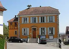 The town hall in Hochstatt | |
.svg.png.webp) Coat of arms | |
Location of Hochstatt | |
 Hochstatt  Hochstatt | |
| Coordinates: 47°42′10″N 7°16′36″E / 47.7028°N 7.2767°E | |
| Country | France |
| Region | Grand Est |
| Department | Haut-Rhin |
| Arrondissement | Altkirch |
| Canton | Altkirch |
| Government | |
| • Mayor (2020–2026) | Matthieu Hecklen[1] |
| Area 1 | 8.55 km2 (3.30 sq mi) |
| Population | 2,177 |
| • Density | 250/km2 (660/sq mi) |
| Time zone | UTC+01:00 (CET) |
| • Summer (DST) | UTC+02:00 (CEST) |
| INSEE/Postal code | 68141 /68720 |
| Elevation | 248–320 m (814–1,050 ft) (avg. 270 m or 890 ft) |
| 1 French Land Register data, which excludes lakes, ponds, glaciers > 1 km2 (0.386 sq mi or 247 acres) and river estuaries. | |
Hochstatt (French pronunciation: [ɔkʃtat]; Alsatian: Hooscht [huːʃt]) is a commune in the Haut-Rhin department in Alsace in north-eastern France.
Population
| Year | Pop. | ±% p.a. |
|---|---|---|
| 1968 | 1,168 | — |
| 1975 | 1,576 | +4.37% |
| 1982 | 1,913 | +2.81% |
| 1990 | 1,831 | −0.55% |
| 1999 | 1,876 | +0.27% |
| 2007 | 2,078 | +1.29% |
| 2012 | 2,085 | +0.07% |
| 2017 | 2,143 | +0.55% |
| Source: INSEE[3] | ||
See also
References
- ↑ "Répertoire national des élus: les maires". data.gouv.fr, Plateforme ouverte des données publiques françaises (in French). 2 December 2020.
- ↑ "Populations légales 2021". The National Institute of Statistics and Economic Studies. 28 December 2023.
- ↑ Population en historique depuis 1968, INSEE
Wikimedia Commons has media related to Hochstatt.
This article is issued from Wikipedia. The text is licensed under Creative Commons - Attribution - Sharealike. Additional terms may apply for the media files.