Rumersheim-le-Haut | |
|---|---|
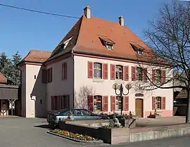 The town hall in Rumersheim-le-Haut | |
.svg.png.webp) Coat of arms | |
Location of Rumersheim-le-Haut | |
 Rumersheim-le-Haut  Rumersheim-le-Haut | |
| Coordinates: 47°51′10″N 7°31′22″E / 47.8528°N 7.5228°E | |
| Country | France |
| Region | Grand Est |
| Department | Haut-Rhin |
| Arrondissement | Colmar-Ribeauvillé |
| Canton | Ensisheim |
| Government | |
| • Mayor (2020–2026) | Thierry Schelcher[1] |
| Area 1 | 16.67 km2 (6.44 sq mi) |
| Population | 1,058 |
| • Density | 63/km2 (160/sq mi) |
| Time zone | UTC+01:00 (CET) |
| • Summer (DST) | UTC+02:00 (CEST) |
| INSEE/Postal code | 68291 /68740 |
| Elevation | 210–224 m (689–735 ft) (avg. 217 m or 712 ft) |
| 1 French Land Register data, which excludes lakes, ponds, glaciers > 1 km2 (0.386 sq mi or 247 acres) and river estuaries. | |
Rumersheim-le-Haut (German: Rumersheim) is a commune in the Haut-Rhin department in Grand Est in north-eastern France.
See also
References
- ↑ "Répertoire national des élus: les maires". data.gouv.fr, Plateforme ouverte des données publiques françaises (in French). 2 December 2020.
- ↑ "Populations légales 2021". The National Institute of Statistics and Economic Studies. 28 December 2023.
Wikimedia Commons has media related to Rumersheim-le-Haut.
This article is issued from Wikipedia. The text is licensed under Creative Commons - Attribution - Sharealike. Additional terms may apply for the media files.