Wittersdorf | |
|---|---|
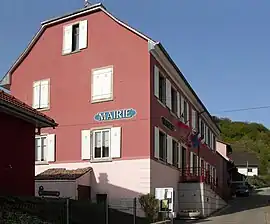 The town hall in Wittersdorf | |
 Flag .svg.png.webp) Coat of arms | |
Location of Wittersdorf | |
 Wittersdorf  Wittersdorf | |
| Coordinates: 47°37′21″N 7°16′34″E / 47.6225°N 7.2761°E | |
| Country | France |
| Region | Grand Est |
| Department | Haut-Rhin |
| Arrondissement | Altkirch |
| Canton | Altkirch |
| Intercommunality | Sundgau |
| Government | |
| • Mayor (2020–2026) | Jean-Marie Freudenberger[1] |
| Area 1 | 4.76 km2 (1.84 sq mi) |
| Population | 787 |
| • Density | 170/km2 (430/sq mi) |
| Time zone | UTC+01:00 (CET) |
| • Summer (DST) | UTC+02:00 (CEST) |
| INSEE/Postal code | 68377 /68130 |
| Elevation | 277–388 m (909–1,273 ft) (avg. 287 m or 942 ft) |
| 1 French Land Register data, which excludes lakes, ponds, glaciers > 1 km2 (0.386 sq mi or 247 acres) and river estuaries. | |
Wittersdorf (French pronunciation: [vitəʁsdɔʁf] ⓘ[3]) is a commune in the Haut-Rhin department in Alsace in north-eastern France.
Population
| Year | Pop. | ±% p.a. |
|---|---|---|
| 1968 | 632 | — |
| 1975 | 687 | +1.20% |
| 1982 | 673 | −0.29% |
| 1990 | 660 | −0.24% |
| 1999 | 690 | +0.50% |
| 2007 | 808 | +1.99% |
| 2012 | 836 | +0.68% |
| 2017 | 806 | −0.73% |
| Source: INSEE[4] | ||
See also
References
- ↑ "Répertoire national des élus: les maires" (in French). data.gouv.fr, Plateforme ouverte des données publiques françaises. 13 September 2022.
- ↑ "Populations légales 2021". The National Institute of Statistics and Economic Studies. 28 December 2023.
- ↑ "Localisation et prononciation des noms de lieux d'Alsace commençant par T, U, V, W ou Z". elsasser.free.fr. Retrieved 2021-07-11.
- ↑ Population en historique depuis 1968, INSEE
Wikimedia Commons has media related to Wittersdorf.
This article is issued from Wikipedia. The text is licensed under Creative Commons - Attribution - Sharealike. Additional terms may apply for the media files.