La Roquille | |
|---|---|
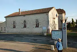 Town hall | |
Location of La Roquille | |
 La Roquille  La Roquille | |
| Coordinates: 44°47′31″N 0°13′56″E / 44.7919°N 0.2322°E | |
| Country | France |
| Region | Nouvelle-Aquitaine |
| Department | Gironde |
| Arrondissement | Libourne |
| Canton | Le Réolais et Les Bastides |
| Intercommunality | Pays Foyen |
| Government | |
| • Mayor (2020–2026) | David Ulmann[1] |
| Area 1 | 3.38 km2 (1.31 sq mi) |
| Population | 312 |
| • Density | 92/km2 (240/sq mi) |
| Time zone | UTC+01:00 (CET) |
| • Summer (DST) | UTC+02:00 (CEST) |
| INSEE/Postal code | 33360 /33220 |
| Elevation | 62–125 m (203–410 ft) (avg. 88 m or 289 ft) |
| 1 French Land Register data, which excludes lakes, ponds, glaciers > 1 km2 (0.386 sq mi or 247 acres) and river estuaries. | |
La Roquille (French pronunciation: [la ʁɔkij]; Occitan: La Roquilha) is a commune in the Gironde department in Nouvelle-Aquitaine in southwestern France. It is located on the D708 route between Sainte-Foy-la-Grande and Margueron.
Population
| Year | Pop. | ±% p.a. |
|---|---|---|
| 1968 | 289 | — |
| 1975 | 264 | −1.28% |
| 1982 | 218 | −2.70% |
| 1990 | 335 | +5.52% |
| 1999 | 312 | −0.79% |
| 2009 | 305 | −0.23% |
| 2014 | 336 | +1.95% |
| 2020 | 313 | −1.17% |
| Source: INSEE[3] | ||
See also
References
- ↑ "Répertoire national des élus: les maires". data.gouv.fr, Plateforme ouverte des données publiques françaises (in French). 2 December 2020.
- ↑ "Populations légales 2021". The National Institute of Statistics and Economic Studies. 28 December 2023.
- ↑ Population en historique depuis 1968, INSEE
Wikimedia Commons has media related to La Roquille.
This article is issued from Wikipedia. The text is licensed under Creative Commons - Attribution - Sharealike. Additional terms may apply for the media files.