Saint-Loubert | |
|---|---|
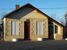 Town hall | |
Location of Saint-Loubert | |
 Saint-Loubert  Saint-Loubert | |
| Coordinates: 44°33′37″N 0°10′28″W / 44.5603°N 0.1744°W | |
| Country | France |
| Region | Nouvelle-Aquitaine |
| Department | Gironde |
| Arrondissement | Langon |
| Canton | Le Sud-Gironde |
| Government | |
| • Mayor (2021–2026) | Christopher Latapy[1] |
| Area 1 | 2.11 km2 (0.81 sq mi) |
| Population | 235 |
| • Density | 110/km2 (290/sq mi) |
| Time zone | UTC+01:00 (CET) |
| • Summer (DST) | UTC+02:00 (CEST) |
| INSEE/Postal code | 33432 /33210 |
| Elevation | 10–46 m (33–151 ft) (avg. 41 m or 135 ft) |
| 1 French Land Register data, which excludes lakes, ponds, glaciers > 1 km2 (0.386 sq mi or 247 acres) and river estuaries. | |
Saint-Loubert (French pronunciation: [sɛ̃ lubɛʁ]; Gascon: Sent Lobèrt) is a commune in the Gironde department in Nouvelle-Aquitaine in southwestern France.
Population
| Year | Pop. | ±% |
|---|---|---|
| 1962 | 123 | — |
| 1968 | 126 | +2.4% |
| 1975 | 122 | −3.2% |
| 1982 | 114 | −6.6% |
| 1990 | 103 | −9.6% |
| 1999 | 129 | +25.2% |
| 2008 | 175 | +35.7% |
See also
References
- ↑ "Répertoire national des élus: les maires" (in French). data.gouv.fr, Plateforme ouverte des données publiques françaises. 4 May 2022.
- ↑ "Populations légales 2021". The National Institute of Statistics and Economic Studies. 28 December 2023.
Wikimedia Commons has media related to Saint-Loubert.
This article is issued from Wikipedia. The text is licensed under Creative Commons - Attribution - Sharealike. Additional terms may apply for the media files.