Saint-Seurin-de-Cursac | |
|---|---|
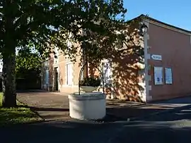 The town hall in Saint-Seurin-de-Cursac | |
.svg.png.webp) Coat of arms | |
Location of Saint-Seurin-de-Cursac | |
 Saint-Seurin-de-Cursac  Saint-Seurin-de-Cursac | |
| Coordinates: 45°09′36″N 0°37′23″W / 45.16°N .6231°W | |
| Country | France |
| Region | Nouvelle-Aquitaine |
| Department | Gironde |
| Arrondissement | Blaye |
| Canton | L'Estuaire |
| Intercommunality | l'Estuaire |
| Government | |
| • Mayor (2020–2026) | Pierre Coronas[1] |
| Area 1 | 2.36 km2 (0.91 sq mi) |
| Population | 770 |
| • Density | 330/km2 (850/sq mi) |
| Time zone | UTC+01:00 (CET) |
| • Summer (DST) | UTC+02:00 (CEST) |
| INSEE/Postal code | 33477 /33390 |
| Elevation | 17–46 m (56–151 ft) (avg. 30 m or 98 ft) |
| 1 French Land Register data, which excludes lakes, ponds, glaciers > 1 km2 (0.386 sq mi or 247 acres) and river estuaries. | |
Saint-Seurin-de-Cursac (French pronunciation: [sɛ̃ sœʁɛ̃ də kyʁsak]) is a commune in the Gironde department in Nouvelle-Aquitaine in southwestern France.[3]
Population
| Year | Pop. | ±% p.a. |
|---|---|---|
| 1968 | 338 | — |
| 1975 | 335 | −0.13% |
| 1982 | 712 | +11.37% |
| 1990 | 738 | +0.45% |
| 1999 | 761 | +0.34% |
| 2007 | 737 | −0.40% |
| 2012 | 689 | −1.34% |
| 2017 | 774 | +2.35% |
| Source: INSEE[4] | ||
See also
References
- ↑ "Répertoire national des élus: les maires" (in French). data.gouv.fr, Plateforme ouverte des données publiques françaises. 13 September 2022.
- ↑ "Populations légales 2021". The National Institute of Statistics and Economic Studies. 28 December 2023.
- ↑ Commune de Saint-Seurin-de-Cursac (33477), INSEE
- ↑ Population en historique depuis 1968, INSEE
Wikimedia Commons has media related to Saint-Seurin-de-Cursac.
This article is issued from Wikipedia. The text is licensed under Creative Commons - Attribution - Sharealike. Additional terms may apply for the media files.