Madhopur Ninaiya
Mādhopur Ninaiyān | |
|---|---|
Village | |
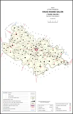 Map showing Madhopur Ninaiya (#465) in Salon CD block | |
 Madhopur Ninaiya Location in Uttar Pradesh, India | |
| Coordinates: 26°02′12″N 81°30′33″E / 26.036539°N 81.509086°E[1] | |
| Country | |
| State | Uttar Pradesh |
| District | Raebareli |
| Area | |
| • Total | 2.326 km2 (0.898 sq mi) |
| Population (2011)[2] | |
| • Total | 1,534 |
| • Density | 660/km2 (1,700/sq mi) |
| Languages | |
| • Official | Hindi |
| Time zone | UTC+5:30 (IST) |
| Vehicle registration | UP-35 |
Madhopur Ninaiya is a village in Salon block of Rae Bareli district, Uttar Pradesh, India.[2] It is located 7 km from Salon, the block and tehsil headquarters.[3] As of 2011, Madhopur Ninaiya has a population of 1,534 people, in 296 households.[2] It has one primary school and no healthcare facilities, and it does not host a permanent market or a periodic haat.[2]
The 1961 census recorded Madhopur Ninaiya as comprising 3 hamlets, with a total population of 586 people (310 male and 276 female), in 122 households and 119 physical houses.[4] The area of the village was given as 568 acres.[4]
The 1981 census recorded Madhopur Ninaiya as having a population of 747 people, in 200 households, and having an area of 231.48 hectares.[3] The main staple foods were given as wheat and juwar.[3]
References
- ↑ "Geonames Search". Do a radial search using these coordinates here.
- 1 2 3 4 5 "Census of India 2011: Uttar Pradesh District Census Handbook - Rae Bareli, Part A (Village and Town Directory)" (PDF). Census 2011 India. pp. 427–51. Retrieved 8 October 2021.
- 1 2 3 Census 1981 Uttar Pradesh: District Census Handbook Part XIII-A: Village & Town Directory, District Rae Bareli (PDF). 1982. pp. 220–1. Retrieved 8 October 2021.
- 1 2 Census 1961: District Census Handbook, Uttar Pradesh (39 - Raebareli District) (PDF). Lucknow. 1965. pp. cvi-cvii of section "Salon Tahsil". Retrieved 8 October 2021.
{{cite book}}: CS1 maint: location missing publisher (link)