Mainleus | |
|---|---|
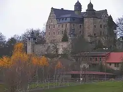 Wernstein Castle | |
 Coat of arms | |
Location of Mainleus within Kulmbach district 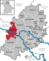 | |
 Mainleus  Mainleus | |
| Coordinates: 50°06′00″N 11°22′45″E / 50.10000°N 11.37917°E | |
| Country | Germany |
| State | Bavaria |
| Admin. region | Oberfranken |
| District | Kulmbach |
| Subdivisions | 42 |
| Government | |
| • Mayor (2020–26) | Robert Bosch[1] (CSU) |
| Area | |
| • Total | 49.41 km2 (19.08 sq mi) |
| Elevation | 306 m (1,004 ft) |
| Population (2022-12-31)[2] | |
| • Total | 6,510 |
| • Density | 130/km2 (340/sq mi) |
| Time zone | UTC+01:00 (CET) |
| • Summer (DST) | UTC+02:00 (CEST) |
| Postal codes | 95336 |
| Dialling codes | 09229 |
| Vehicle registration | KU |
| Website | www.mainleus.de |
Mainleus is a municipality in the district of Kulmbach in Bavaria in Germany, the site of a post World War II American sector displaced person camp.
Town administrative division
Mainleus is arranged in the following boroughs:
|
|
|
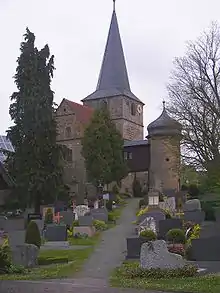
Church and cemetery of Veitlahm
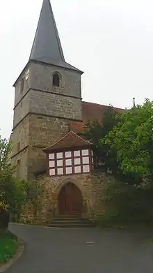
Church of Veitlahm
References
- ↑ Liste der ersten Bürgermeister/Oberbürgermeister in kreisangehörigen Gemeinden, Bayerisches Landesamt für Statistik, 15 July 2021.
- ↑ Genesis Online-Datenbank des Bayerischen Landesamtes für Statistik Tabelle 12411-003r Fortschreibung des Bevölkerungsstandes: Gemeinden, Stichtag (Einwohnerzahlen auf Grundlage des Zensus 2011)
Towns and municipalities in Kulmbach (district) | ||
|---|---|---|
This article is issued from Wikipedia. The text is licensed under Creative Commons - Attribution - Sharealike. Additional terms may apply for the media files.