Mečichov | |
|---|---|
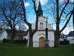 Chapel of Saint Adalbert | |
 Flag  Coat of arms | |
 Mečichov Location in the Czech Republic | |
| Coordinates: 49°20′52″N 13°48′43″E / 49.34778°N 13.81194°E | |
| Country | |
| Region | South Bohemian |
| District | Strakonice |
| First mentioned | 1539 |
| Area | |
| • Total | 8.86 km2 (3.42 sq mi) |
| Elevation | 494 m (1,621 ft) |
| Population (2023-01-01)[1] | |
| • Total | 300 |
| • Density | 34/km2 (88/sq mi) |
| Time zone | UTC+1 (CET) |
| • Summer (DST) | UTC+2 (CEST) |
| Postal code | 387 36 |
| Website | mecichov |
Mečichov is a municipality and village in Strakonice District in the South Bohemian Region of the Czech Republic. It has about 300 inhabitants.
Mečichov lies approximately 13 kilometres (8 mi) north-west of Strakonice, 65 km (40 mi) north-west of České Budějovice, and 94 km (58 mi) south-west of Prague.
References
Wikimedia Commons has media related to Mečichov.
This article is issued from Wikipedia. The text is licensed under Creative Commons - Attribution - Sharealike. Additional terms may apply for the media files.