Port-Mort | |
|---|---|
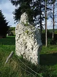 Menhir | |
 Coat of arms | |
Location of Port-Mort | |
 Port-Mort  Port-Mort | |
| Coordinates: 49°09′55″N 1°24′57″E / 49.1653°N 1.4158°E | |
| Country | France |
| Region | Normandy |
| Department | Eure |
| Arrondissement | Les Andelys |
| Canton | Les Andelys |
| Intercommunality | Seine Normandie Agglomération |
| Government | |
| • Mayor (2022–2026) | Gilles Auloy[1] |
| Area 1 | 12.17 km2 (4.70 sq mi) |
| Population | 897 |
| • Density | 74/km2 (190/sq mi) |
| Time zone | UTC+01:00 (CET) |
| • Summer (DST) | UTC+02:00 (CEST) |
| INSEE/Postal code | 27473 /27940 |
| Elevation | 8–138 m (26–453 ft) (avg. 32 m or 105 ft) |
| 1 French Land Register data, which excludes lakes, ponds, glaciers > 1 km2 (0.386 sq mi or 247 acres) and river estuaries. | |
Port-Mort (French pronunciation: [pɔʁ mɔʁ]) is a commune in the Eure department in Normandy in northern France.
Population
| Year | Pop. | ±% |
|---|---|---|
| 1962 | 421 | — |
| 1968 | 431 | +2.4% |
| 1975 | 563 | +30.6% |
| 1982 | 672 | +19.4% |
| 1990 | 839 | +24.9% |
| 1999 | 820 | −2.3% |
| 2008 | 1,009 | +23.0% |
See also
References
- ↑ "Répertoire national des élus: les maires" (in French). data.gouv.fr, Plateforme ouverte des données publiques françaises. 4 May 2022.
- ↑ "Populations légales 2021". The National Institute of Statistics and Economic Studies. 28 December 2023.
External links
Wikimedia Commons has media related to Port-Mort.
This article is issued from Wikipedia. The text is licensed under Creative Commons - Attribution - Sharealike. Additional terms may apply for the media files.