Rugles | |
|---|---|
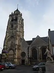 The church in Rugles | |
.svg.png.webp) Coat of arms | |
Location of Rugles | |
 Rugles  Rugles | |
| Coordinates: 48°49′23″N 0°42′39″E / 48.8231°N 0.7108°E | |
| Country | France |
| Region | Normandy |
| Department | Eure |
| Arrondissement | Bernay |
| Canton | Breteuil |
| Government | |
| • Mayor (2020–2026) | Denis Guitton[1] |
| Area 1 | 14.1 km2 (5.4 sq mi) |
| Population | 2,199 |
| • Density | 160/km2 (400/sq mi) |
| Time zone | UTC+01:00 (CET) |
| • Summer (DST) | UTC+02:00 (CEST) |
| INSEE/Postal code | 27502 /27250 |
| Elevation | 171–236 m (561–774 ft) (avg. 120 m or 390 ft) |
| 1 French Land Register data, which excludes lakes, ponds, glaciers > 1 km2 (0.386 sq mi or 247 acres) and river estuaries. | |
Rugles (French pronunciation: [ʁyɡl]) is a commune in the Eure department in Normandy in northern France.
Population
| Year | Pop. | ±% p.a. |
|---|---|---|
| 1968 | 2,688 | — |
| 1975 | 2,644 | −0.24% |
| 1982 | 2,539 | −0.58% |
| 1990 | 2,416 | −0.62% |
| 1999 | 2,549 | +0.60% |
| 2007 | 2,410 | −0.70% |
| 2012 | 2,350 | −0.50% |
| 2017 | 2,246 | −0.90% |
| Source: INSEE[3] | ||
See also
References
- ↑ "Répertoire national des élus: les maires". data.gouv.fr, Plateforme ouverte des données publiques françaises (in French). 2 December 2020.
- ↑ "Populations légales 2021". The National Institute of Statistics and Economic Studies. 28 December 2023.
- ↑ Population en historique depuis 1968, INSEE
External links
Wikimedia Commons has media related to Rugles.
This article is issued from Wikipedia. The text is licensed under Creative Commons - Attribution - Sharealike. Additional terms may apply for the media files.