Routot | |
|---|---|
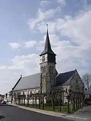 The church in Routot | |
.svg.png.webp) Coat of arms | |
Location of Routot | |
 Routot  Routot | |
| Coordinates: 49°22′44″N 0°44′08″E / 49.3789°N 0.7356°E | |
| Country | France |
| Region | Normandy |
| Department | Eure |
| Arrondissement | Bernay |
| Canton | Bourg-Achard |
| Government | |
| • Mayor (2020–2026) | Marie-Jean Douyere[1] |
| Area 1 | 6.61 km2 (2.55 sq mi) |
| Population | 1,670 |
| • Density | 250/km2 (650/sq mi) |
| Time zone | UTC+01:00 (CET) |
| • Summer (DST) | UTC+02:00 (CEST) |
| INSEE/Postal code | 27500 /27350 |
| Elevation | 91–142 m (299–466 ft) (avg. 140 m or 460 ft) |
| 1 French Land Register data, which excludes lakes, ponds, glaciers > 1 km2 (0.386 sq mi or 247 acres) and river estuaries. | |
Routot (French pronunciation: [ʁuto]) is a commune in the Eure department in north-western France.
Population
| Year | Pop. | ±% p.a. |
|---|---|---|
| 1968 | 882 | — |
| 1975 | 988 | +1.63% |
| 1982 | 1,079 | +1.27% |
| 1990 | 1,043 | −0.42% |
| 1999 | 1,115 | +0.74% |
| 2009 | 1,367 | +2.06% |
| 2014 | 1,499 | +1.86% |
| 2020 | 1,699 | +2.11% |
| Source: INSEE[3] | ||
See also
References
- ↑ "Répertoire national des élus: les maires" (in French). data.gouv.fr, Plateforme ouverte des données publiques françaises. 13 September 2022.
- ↑ "Populations légales 2021". The National Institute of Statistics and Economic Studies. 28 December 2023.
- ↑ Population en historique depuis 1968, INSEE
Wikimedia Commons has media related to Routot.
This article is issued from Wikipedia. The text is licensed under Creative Commons - Attribution - Sharealike. Additional terms may apply for the media files.