 | ||||
|---|---|---|---|---|
| Bóthar R664 | ||||
 | ||||
| Route information | ||||
| Length | 9.0 km (5.6 mi) | |||
| Major junctions | ||||
| From | ||||
| ||||
| To | ||||
| Location | ||||
| Country | Ireland | |||
| Highway system | ||||
| ||||
The R664 road is a regional road in County Tipperary, Ireland.[1][2]
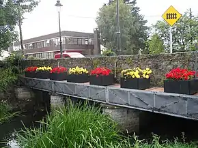
It runs from Tipperary's main street southwards, crossing the River Ara and the railway line before meeting the R663 (Bansha–Garryspillane road).[3][4]
References
- ↑ "The road less travelled through the glen". The Irish Times.
- ↑ Somerville, Christopher (3 March 2011). Walking in Ireland. Random House. ISBN 9781407079998 – via Google Books.
- ↑ "Gortavoher - Tipperary Town". www.tipperarytown.ie.
- ↑ "Archived copy" (PDF). Archived from the original (PDF) on 17 November 2017. Retrieved 20 November 2017.
{{cite web}}: CS1 maint: archived copy as title (link)
52°28′14″N 8°09′39″W / 52.470583°N 8.160869°W
This article is issued from Wikipedia. The text is licensed under Creative Commons - Attribution - Sharealike. Additional terms may apply for the media files.