Saint-Carreuc
Sant-Kareg | |
|---|---|
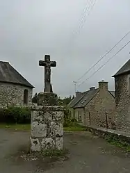 The cross of Saint-Guéhen, in Saint-Carreuc | |
Location of Saint-Carreuc | |
 Saint-Carreuc  Saint-Carreuc | |
| Coordinates: 48°23′57″N 2°43′49″W / 48.3992°N 2.7303°W | |
| Country | France |
| Region | Brittany |
| Department | Côtes-d'Armor |
| Arrondissement | Saint-Brieuc |
| Canton | Plaintel |
| Intercommunality | Saint-Brieuc Armor |
| Government | |
| • Mayor (2020–2026) | Laurence Mahé[1] |
| Area 1 | 12.69 km2 (4.90 sq mi) |
| Population | 1,532 |
| • Density | 120/km2 (310/sq mi) |
| Time zone | UTC+01:00 (CET) |
| • Summer (DST) | UTC+02:00 (CEST) |
| INSEE/Postal code | 22281 /22150 |
| Elevation | 125–237 m (410–778 ft) |
| 1 French Land Register data, which excludes lakes, ponds, glaciers > 1 km2 (0.386 sq mi or 247 acres) and river estuaries. | |
Saint-Carreuc (French pronunciation: [sɛ̃ kaʁœk]; Gallo: Saent-Caroec) is a commune in the Côtes-d'Armor department of Brittany in northwestern France.
Population
| Year | Pop. | ±% |
|---|---|---|
| 1962 | 965 | — |
| 1968 | 917 | −5.0% |
| 1975 | 859 | −6.3% |
| 1982 | 1,072 | +24.8% |
| 1990 | 1,217 | +13.5% |
| 1999 | 1,227 | +0.8% |
| 2008 | 1,476 | +20.3% |
Inhabitants of Saint-Carreuc are called carreucois in French.
See also
References
- ↑ "Répertoire national des élus: les maires" (in French). data.gouv.fr, Plateforme ouverte des données publiques françaises. 13 September 2022.
- ↑ "Populations légales 2021". The National Institute of Statistics and Economic Studies. 28 December 2023.
External links
Wikimedia Commons has media related to Saint-Carreuc.
- Base Mérimée: Search for heritage in the commune, Ministère français de la Culture. (in French)
This article is issued from Wikipedia. The text is licensed under Creative Commons - Attribution - Sharealike. Additional terms may apply for the media files.