Tréogan
Treogan | |
|---|---|
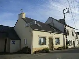 The town hall of Tréogan | |
 Coat of arms | |
Location of Tréogan | |
 Tréogan  Tréogan | |
| Coordinates: 48°11′24″N 3°31′07″W / 48.19°N 3.5186°W | |
| Country | France |
| Region | Brittany |
| Department | Côtes-d'Armor |
| Arrondissement | Guingamp |
| Canton | Rostrenen |
| Intercommunality | Poher Communauté |
| Government | |
| • Mayor (2021–2026) | Thierry Dahirel[1] |
| Area 1 | 7.10 km2 (2.74 sq mi) |
| Population | 108 |
| • Density | 15/km2 (39/sq mi) |
| Time zone | UTC+01:00 (CET) |
| • Summer (DST) | UTC+02:00 (CEST) |
| INSEE/Postal code | 22373 /22340 |
| Elevation | 135–293 m (443–961 ft) |
| 1 French Land Register data, which excludes lakes, ponds, glaciers > 1 km2 (0.386 sq mi or 247 acres) and river estuaries. | |
Tréogan (Breton: Treogan) is a commune in the Côtes-d'Armor department of Brittany in northwestern France.
Population
| Year | Pop. | ±% p.a. |
|---|---|---|
| 1968 | 168 | — |
| 1975 | 160 | −0.69% |
| 1982 | 162 | +0.18% |
| 1990 | 138 | −1.98% |
| 1999 | 119 | −1.63% |
| 2009 | 98 | −1.92% |
| 2014 | 99 | +0.20% |
| 2020 | 104 | +0.82% |
| Source: INSEE[3] | ||
Inhabitants of Tréogan are called tréoganais in French.
See also
References
- ↑ "Répertoire national des élus: les maires" (in French). data.gouv.fr, Plateforme ouverte des données publiques françaises. 4 May 2022.
- ↑ "Populations légales 2021". The National Institute of Statistics and Economic Studies. 28 December 2023.
- ↑ Population en historique depuis 1968, INSEE
External links
Wikimedia Commons has media related to Tréogan.
- Base Mérimée: Search for heritage in the commune, Ministère français de la Culture. (in French)
This article is issued from Wikipedia. The text is licensed under Creative Commons - Attribution - Sharealike. Additional terms may apply for the media files.