Saint-Samson-sur-Rance
Sant-Samzun | |
|---|---|
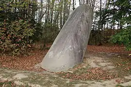 Menhir | |
.svg.png.webp) Coat of arms | |
Location of Saint-Samson-sur-Rance | |
 Saint-Samson-sur-Rance  Saint-Samson-sur-Rance | |
| Coordinates: 48°29′32″N 2°01′47″W / 48.4922°N 2.0297°W | |
| Country | France |
| Region | Brittany |
| Department | Côtes-d'Armor |
| Arrondissement | Dinan |
| Canton | Pleslin-Trigavou |
| Intercommunality | Dinan Agglomération |
| Government | |
| • Mayor (2020–2026) | Loïc Lorre[1] |
| Area 1 | 6.27 km2 (2.42 sq mi) |
| Population | 1,635 |
| • Density | 260/km2 (680/sq mi) |
| Time zone | UTC+01:00 (CET) |
| • Summer (DST) | UTC+02:00 (CEST) |
| INSEE/Postal code | 22327 /22100 |
| Elevation | 4–78 m (13–256 ft) |
| 1 French Land Register data, which excludes lakes, ponds, glaciers > 1 km2 (0.386 sq mi or 247 acres) and river estuaries. | |
Saint-Samson-sur-Rance (French pronunciation: [sɛ̃ sɑ̃sɔ̃ syʁ ʁɑ̃s], literally Saint-Samson on Rance; Breton: Sant-Samzun) is a commune in the Côtes-d'Armor department of Brittany in northwestern France.
Population
| Year | Pop. | ±% |
|---|---|---|
| 1962 | 460 | — |
| 1968 | 477 | +3.7% |
| 1975 | 548 | +14.9% |
| 1982 | 874 | +59.5% |
| 1990 | 1,180 | +35.0% |
| 1999 | 1,151 | −2.5% |
| 2008 | 1,508 | +31.0% |
Inhabitants of Saint-Samson-sur-Rance are called samsonnais in French.
See also
References
- ↑ "Répertoire national des élus: les maires". data.gouv.fr, Plateforme ouverte des données publiques françaises (in French). 2 December 2020.
- ↑ "Populations légales 2021". The National Institute of Statistics and Economic Studies. 28 December 2023.
External links
Wikimedia Commons has media related to Saint-Samson-sur-Rance.
- Base Mérimée: Search for heritage in the commune, Ministère français de la Culture. (in French)
This article is issued from Wikipedia. The text is licensed under Creative Commons - Attribution - Sharealike. Additional terms may apply for the media files.