Saint-Menge | |
|---|---|
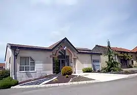 The town hall in Saint-Menge | |
 Coat of arms | |
Location of Saint-Menge | |
 Saint-Menge  Saint-Menge | |
| Coordinates: 48°17′23″N 5°57′18″E / 48.2897°N 5.955°E | |
| Country | France |
| Region | Grand Est |
| Department | Vosges |
| Arrondissement | Neufchâteau |
| Canton | Mirecourt |
| Intercommunality | CC l'Ouest Vosgien |
| Government | |
| • Mayor (2020–2026) | Jean-Yves Vagnier[1] |
| Area 1 | 6.67 km2 (2.58 sq mi) |
| Population | 121 |
| • Density | 18/km2 (47/sq mi) |
| Time zone | UTC+01:00 (CET) |
| • Summer (DST) | UTC+02:00 (CEST) |
| INSEE/Postal code | 88427 /88170 |
| Elevation | 320–406 m (1,050–1,332 ft) (avg. 330 m or 1,080 ft) |
| 1 French Land Register data, which excludes lakes, ponds, glaciers > 1 km2 (0.386 sq mi or 247 acres) and river estuaries. | |
Saint-Menge (French pronunciation: [sɛ̃ mɑ̃ʒ] ⓘ) is a commune in the Vosges department in Grand Est in northeastern France.
Heraldry
Arms of Saint-Menge |
The arms of Saint-Menge are blazoned : Azure, an inescutcheon argent. (Gouzeaucourt, Saint-Jean-de-Vals, Ramburelles, Saint-Menge, Colombey-les-Belles and Ostreville use the same arms.)
|
See also
References
- ↑ "Répertoire national des élus: les maires". data.gouv.fr, Plateforme ouverte des données publiques françaises (in French). 2 December 2020.
- ↑ "Populations légales 2021". The National Institute of Statistics and Economic Studies. 28 December 2023.
Wikimedia Commons has media related to Saint-Menge.
This article is issued from Wikipedia. The text is licensed under Creative Commons - Attribution - Sharealike. Additional terms may apply for the media files.